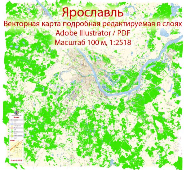
Yaroslavl is a historic city located in central Russia, on the banks of the Volga River. It has a rich history and is known for its numerous bridges and water resources. Here’s some information about Yaroslavl’s water resources and bridges:
- Volga River: The Volga River is one of the most significant water resources in Yaroslavl. It is the longest river in Europe and flows through the city, dividing it into two parts. The river has played a vital role in the city’s history, serving as a transportation route and a source of water for various activities.
- Kotorosl River: The Kotorosl River is another important watercourse in Yaroslavl. It flows into the Volga River within the city and has a significant impact on the city’s landscape. Numerous bridges span the Kotorosl, connecting different parts of the city.
- Bridges: Yaroslavl is often referred to as the “City of Bridges” because it has numerous bridges that connect its various districts across the rivers. Some of the notable bridges in Yaroslavl include:
a. Volga Bridge: This bridge connects the two parts of the city, crossing the Volga River. It is an essential transportation link for both residents and visitors.
b. Millennium Bridge: This pedestrian bridge spans the Kotorosl River and offers stunning views of the city and its surroundings.
c. Dzerzhinsky Bridge: This is another key bridge in Yaroslavl, providing access to different parts of the city over the Kotorosl River.
d. Yaroslavl-Spasskaya Bridge: This is one of the historic bridges in the city and adds to Yaroslavl’s architectural charm.
These bridges are not only functional but also serve as landmarks and picturesque spots for tourists to enjoy the city’s scenery.
Yaroslavl’s water resources and bridges play a crucial role in its history, transportation, and urban development, making it a city with a unique and beautiful waterfront landscape.


 Author: Kirill Shrayber, Ph.D. FRGS