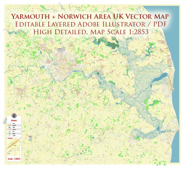
The Yarmouth and Norwich area in the UK, which is in the county of Norfolk, is rich in water resources and features several bridges due to its proximity to the River Yare and the Norfolk Broads. Here are some key points about the water resources and bridges in the Yarmouth and Norwich area:
- River Yare: The River Yare is a prominent waterway in this region. It flows from southwest to northeast, passing through Norwich before reaching Great Yarmouth, where it meets the North Sea. The river is navigable and plays a crucial role in transportation.
- Norfolk Broads: The Norfolk Broads are a series of interconnected lakes and rivers that form a unique wetland area. They are a popular destination for boating and are known for their natural beauty. Numerous bridges span the rivers and broads to facilitate both road and waterway traffic.
- Bridges in Norwich: Norwich, as the regional capital, has several bridges over the River Yare and its tributaries. Some notable ones include:
- Trowse Bridge: This is a significant road and rail bridge that connects the eastern and western parts of Norwich.
- Foundry Bridge: Located near the city center, it is an important road bridge.
- Bishops Bridge: Another road bridge that provides a link across the River Wensum in the city.
- Bridges in Great Yarmouth: Great Yarmouth is a coastal town at the mouth of the River Yare, and it also has several bridges:
- Breydon Bridge: This bridge connects the town to the southern part of the borough and is important for both road and rail traffic.
- Haven Bridge: An iconic bascule bridge that allows ships to pass through to the inner harbor of Yarmouth.
- Water Resources Management: Given the importance of the River Yare and the Norfolk Broads, water resources management in the area is crucial for flood control, navigation, and environmental preservation. Various agencies and organizations work to maintain the waterways and protect the unique ecology of the Broads.
- Tourism and Recreation: The water resources and bridges in this area are not only functional but also a significant draw for tourism and recreation. The Norfolk Broads, in particular, are a popular destination for boating, fishing, and birdwatching.
- Environmental Considerations: The Norfolk Broads are a protected national park, and efforts are made to balance economic activities with environmental conservation. Sustainable practices are encouraged to preserve the unique flora and fauna of the area.
The Yarmouth and Norwich area’s water resources and bridges are integral to the region’s identity, serving both as transportation routes and as recreational and environmental assets. They contribute to the charm and character of this part of Norfolk, attracting visitors and supporting local communities.


 Author: Kirill Shrayber, Ph.D. FRGS