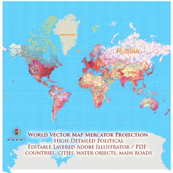
The Mercator projection is a cylindrical map projection that distorts the size and shape of landmasses as they get farther from the equator. While it’s commonly used for world maps, it has limitations, especially when depicting highway systems or other features requiring accurate representation of size and shape.
Here’s a general description of the Mercator projection and how it affects the representation of highway systems:
- Distortion of Size: The Mercator projection greatly exaggerates the sizes of land areas near the poles. This means that highways and road networks in these regions will appear much larger on the map than they are in reality. For example, highways in Canada and Russia will seem larger than those in equatorial regions.
- Straight East-West Lines: In the Mercator projection, lines of constant bearing (loxodromes) appear as straight lines. This is helpful for navigation but can be misleading when depicting highway systems, especially in areas where roads don’t follow a strict east-west orientation.
- Distorted Shapes: The Mercator projection distorts the shapes of landmasses as you move away from the equator. This distortion can make highways appear curved or distorted, which can be problematic when trying to represent road systems accurately.
- Greenland Effect: One of the most famous examples of the Mercator distortion is the “Greenland effect.” On Mercator maps, Greenland appears roughly the same size as Africa, while in reality, Africa is many times larger. This can lead to misconceptions about the scale and importance of highway systems in different parts of the world.
- Conformal Projection: The Mercator projection is a conformal projection, meaning it preserves angles and shapes locally. This property is useful for navigation, but it distorts size and can make highway networks in different parts of the world appear more similar in shape than they are in reality.
When working with highway systems and the Mercator projection, it’s essential to keep these distortions in mind. If you need to accurately represent the size and shape of highway networks, other map projections like the Winkel Tripel or the Eckert IV might be more suitable as they provide a more balanced representation of both size and shape, although they still have their own limitations.


 Author: Kirill Shrayber, Ph.D.