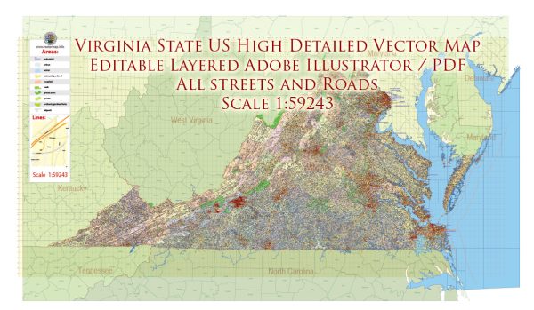
Virginia is home to a variety of water resources and bridges due to its diverse geography and numerous rivers, lakes, and streams. Here are some key water resources and notable bridges in the state of Virginia:
Water Resources:
- Chesapeake Bay: The Chesapeake Bay is the largest estuary in the United States and a vital water resource for Virginia. It’s known for its rich marine life and serves as a major source of seafood for the state.
- James River: The James River flows through central Virginia and is a significant waterway. It provides drinking water to many communities and offers recreational opportunities like boating and fishing.
- Potomac River: The Potomac River forms part of the northern border of Virginia, separating the state from Maryland. It is a major water source for the region and is historically significant.
- Shenandoah River: The Shenandoah River is a tributary of the Potomac River and runs through the Shenandoah Valley. It is popular for its scenic beauty and is a great spot for outdoor activities.
- Lake Anna: Lake Anna is a man-made reservoir in central Virginia. It’s a popular destination for boating, fishing, and water recreation.
- Smith Mountain Lake: This large, man-made lake is located in southwestern Virginia and offers opportunities for boating, fishing, and lakeside living.
Notable Bridges:
- Chesapeake Bay Bridge-Tunnel: This engineering marvel connects Virginia’s Eastern Shore with the mainland and includes a combination of bridges, tunnels, and causeways. It spans the Chesapeake Bay and is one of the most iconic structures in the state.
- George P. Coleman Memorial Bridge: This double swing-span bridge carries U.S. Route 17 across the York River between Yorktown and Gloucester Point. It’s a critical transportation link in the region.
- James River Bridge: The James River Bridge spans the James River, connecting Newport News and Isle of Wight County. It’s a major commuter route in the Hampton Roads area.
- Woodrow Wilson Bridge: While the majority of this bridge is in Maryland, it connects Virginia to Maryland across the Potomac River and is a key transportation link for the Washington, D.C. metropolitan area.
- Jordan’s Point Bridge: Located in Lexington, Virginia, this historic bridge is a notable local landmark and offers scenic views of the city.
- Afton Mountain Bridge: Part of Interstate 64, this bridge crosses the Blue Ridge Mountains, offering breathtaking views of the Shenandoah Valley.
These are just a few of the many water resources and bridges in Virginia. The state’s geography and infrastructure play a crucial role in transportation, commerce, and recreation.


 Author: Kirill Shrayber, Ph.D.