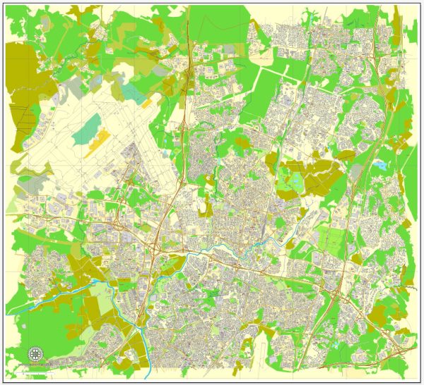
Vantaa is a city located in southern Finland, and it is a part of the Greater Helsinki metropolitan area. The city has several water resources, including rivers, lakes, and the Gulf of Finland coastline. Some notable water bodies and bridges in Vantaa include:
- River Vantaa: The city is named after the River Vantaa, which flows through the municipality. The river is a significant water resource and provides opportunities for various recreational activities such as fishing and boating.
- Lake Tuusula: This lake is situated to the north of Vantaa and is known for its scenic beauty. Several bridges and causeways connect the shores of Lake Tuusula and its islands, providing access to recreational areas and cultural attractions.
- Gulf of Finland: Vantaa’s southern border is formed by the Gulf of Finland, part of the Baltic Sea. The city’s coastline offers opportunities for seaside activities and connects to the Helsinki metropolitan area via various road and rail bridges.
- Kehä III (Ring III) Bridge: This bridge is a vital transport link in the Helsinki metropolitan area. It spans the River Vantaa, connecting Vantaa to the neighboring city of Espoo and other parts of the Helsinki region.
- Håkansböle Bridge: This bridge crosses the River Vantaa and connects the Vantaa and Sipoo municipalities. It plays a significant role in regional transportation.
- Various pedestrian and cycling bridges: Vantaa has numerous pedestrian and cycling bridges that provide safe and convenient crossings over water bodies and roads. These bridges are essential for the city’s active transportation network.
Vantaa’s water resources and bridges play a crucial role in both transportation and recreational activities for its residents and visitors. The city’s proximity to the Gulf of Finland and its network of water bodies make it a significant part of the greater Helsinki region’s infrastructure and natural beauty.


 Author: Kirill Shrayber, Ph.D. FRGS