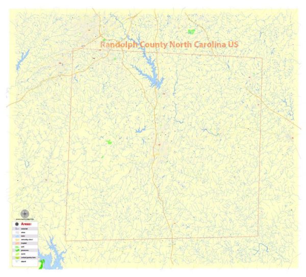
Randolph County is located in the U.S. state of North Carolina and is known for its diverse water resources and numerous bridges.
Water Resources:
- Rivers and Streams: Randolph County is home to several rivers and streams, including the Deep River and the Uwharrie River. These water bodies provide a source of freshwater and support various aquatic ecosystems.
- Reservoirs and Lakes: Randleman Lake is a significant reservoir located in Randolph County. It serves as a source of drinking water, recreational activities, and is managed by the City of High Point and the Piedmont Triad Regional Water Authority.
- Groundwater: Like many areas in North Carolina, Randolph County relies on groundwater sources for drinking water. Various private and public wells access this groundwater to supply the county’s residents.
Bridges: Randolph County has a network of bridges that help connect different parts of the county and provide transportation infrastructure. Some notable bridges in the county may include:
- Highway Bridges: Interstate 73/74 runs through Randolph County, and there are numerous highway bridges that cross various bodies of water and provide access to different parts of the county.
- Pedestrian Bridges: In addition to vehicular bridges, there are pedestrian bridges that span creeks and rivers, providing safe passage for pedestrians and cyclists.
- Historic Bridges: Randolph County may also have some historic bridges that are preserved for their cultural and architectural significance. These bridges can be found throughout the county and often serve as picturesque landmarks.
For the most current and specific information about water resources and bridges in Randolph County, I recommend contacting the local government, such as the Randolph County government, the North Carolina Department of Transportation, or relevant water authorities. They can provide up-to-date information, including any recent developments or changes in the county’s water resources and bridge infrastructure.


 Author: Kirill Shrayber, Ph.D. FRGS