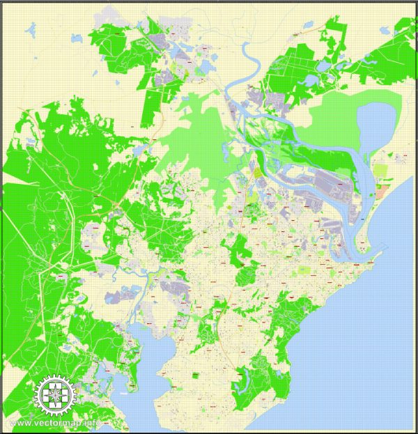
Newcastle, Australia, is a coastal city located in New South Wales. It has several significant water resources and bridges that play essential roles in the city’s infrastructure and daily life. Here are some key water resources and bridges in Newcastle:
Water Resources:
- Hunter River: The Hunter River is one of the most important water resources in the Newcastle region. It flows through the city and is used for various purposes, including water supply, irrigation, and transportation.
- Newcastle Harbour: The Newcastle Harbour is a major port that handles a significant portion of New South Wales’ coal exports. It also serves as a hub for general cargo and container shipping. The water in the harbor is crucial for the region’s economic activities.
- Water Supply: Newcastle’s water supply primarily comes from the Lower Hunter Water Supply Scheme, which includes several dams and reservoirs, such as Chichester Dam, Grahamstown Dam, and Tomago Sandbeds. These sources provide potable water to the city and its surrounding areas.
- Beaches: Newcastle is known for its beautiful beaches, including Nobby’s Beach, Newcastle Beach, and Merewether Beach. These coastal areas are important recreational and tourism assets, and the ocean water is a valuable resource for various water sports and activities.
Bridges:
- Newcastle Harbour Bridge: The Newcastle Harbour Bridge, also known as the Stockton Bridge, connects the city of Newcastle with the suburb of Stockton. It is a bascule bridge, allowing it to be raised to accommodate the passage of tall vessels in and out of the harbor.
- Hunter River Railway Bridge: This railway bridge spans the Hunter River, connecting the cities of Newcastle and Maitland. It plays a crucial role in transporting goods and people between these areas.
- Honeysuckle Footbridge: The Honeysuckle Footbridge is a pedestrian and cyclist bridge that provides a direct connection from the city center to the Honeysuckle precinct, a popular dining and entertainment area along the waterfront.
- Hexham Bridge: Located to the northwest of Newcastle, the Hexham Bridge is a major road bridge that carries the Pacific Highway (M1) over the Hunter River. It is a significant transportation link for road travelers.
These water resources and bridges are essential components of Newcastle’s infrastructure, contributing to the city’s economic development, transportation, and quality of life. The Hunter River and Newcastle Harbour, in particular, have historically been vital to the region’s growth and continue to play key roles in its prosperity.


 Author: Kirill Shrayber, Ph.D.