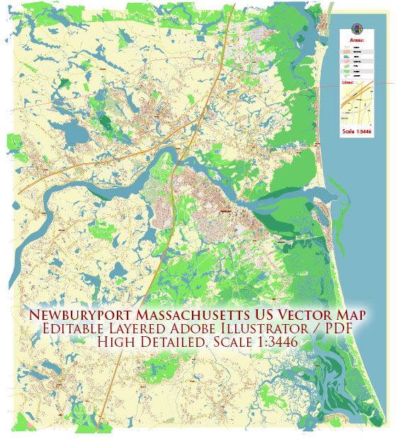
Newburyport, Massachusetts, is a coastal city located on the North Shore of Massachusetts. It has several water resources, most notably the Merrimack River, which flows through the city and serves as a vital natural feature. Here are some key points about water resources and bridges in Newburyport:
- Merrimack River: The Merrimack River is a significant water resource in the area. It flows through Newburyport and plays a crucial role in the city’s history and economy. The river is used for recreational activities like boating and fishing and is also important for transportation and commerce.
- Bridges: Newburyport has several bridges that span the Merrimack River and connect the city to other areas. Some of the notable bridges include:
- Merrimack River Bridge: This is a major bridge that connects Newburyport to the town of Amesbury. It is a critical transportation link in the region.
- Chain Bridge: The Chain Bridge is a historic suspension bridge that connects Newburyport to Deer Island. It is known for its unique design and is a popular tourist attraction.
- Whittier Bridge: The Whittier Bridge is part of Interstate 95 and crosses the Merrimack River. It serves as a significant transportation route for both residents and travelers passing through the area.
These bridges are essential for facilitating the flow of traffic and commerce in and out of Newburyport and contribute to the city’s connectivity with the surrounding region.
- Plum Island: Plum Island, located just off the coast of Newburyport, is another important feature. It is a barrier island that provides natural protection to Newburyport from the Atlantic Ocean. Plum Island is known for its beaches, salt marshes, and birdwatching opportunities.
- Waterfront and Harbor: Newburyport’s waterfront and harbor areas are also essential water resources. They provide opportunities for recreational activities, including boating, sailing, and fishing. The harbor area is a hub for local businesses and tourism.
- Watershed Management: Given its proximity to the Merrimack River, Newburyport participates in watershed management efforts to protect water quality and preserve the natural environment of the river and its surrounding areas.
It’s important to note that the state of water resources and bridges in Newburyport may evolve over time due to maintenance, development, and environmental factors. Therefore, it’s recommended to check with local authorities and agencies for the most up-to-date information regarding water resources and bridge conditions in the city.


 Author: Kirill Shrayber, Ph.D. FRGS