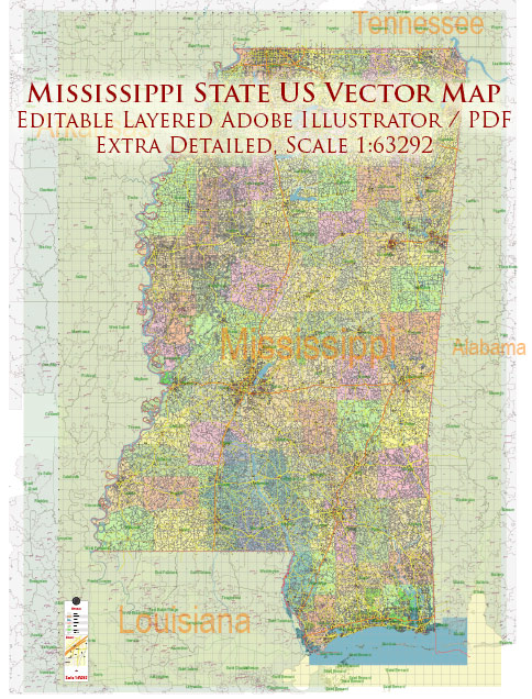
Mississippi is a state in the southern United States, and it has a variety of water resources and bridges that play a significant role in the state’s transportation and economy. Here’s an overview of Mississippi’s water resources and bridges:
Water Resources:
- Mississippi River: The Mississippi River is one of the most important waterways in the United States. It flows through the western part of Mississippi, forming the state’s western border. The river serves as a major transportation route for goods and commodities, and it also plays a crucial role in agriculture, particularly in the Delta region.
- Tennessee-Tombigbee Waterway: This is a man-made waterway that connects the Tennessee River to the Tombigbee River, which flows through Mississippi. The waterway has provided a significant boost to the state’s shipping and transportation industries.
- Gulf of Mexico: The southern border of Mississippi is formed by the Gulf of Mexico. The coastline is dotted with beautiful beaches and is a popular destination for tourism and recreational activities.
- Reservoirs and Lakes: Mississippi has numerous reservoirs and lakes that provide water for various purposes, including recreation, fishing, and water supply. Some well-known ones include Sardis Lake, Grenada Lake, and Ross Barnett Reservoir.
- Wetlands: The state is home to extensive wetlands, which are ecologically important for wildlife habitat and flood control. The Mississippi Delta region, in particular, contains valuable wetlands.
Bridges:
- Vicksburg Bridge: This is a significant bridge that carries Interstate 20 over the Mississippi River in Vicksburg, Mississippi. It’s a vital transportation link for both interstate and international trade.
- Old Mississippi River Bridge: Also known as the Hernando De Soto Bridge, this bridge connects Memphis, Tennessee, to West Memphis, Arkansas, crossing the Mississippi River. While not within Mississippi’s borders, it plays a crucial role in connecting the state to the broader transportation network.
- Bay St. Louis Bridge: This bridge spans St. Louis Bay, connecting the cities of Bay St. Louis and Pass Christian. It’s an important transportation link on the Mississippi Gulf Coast.
- Biloxi Bay Bridge: This bridge connects the cities of Biloxi and Ocean Springs and plays a key role in facilitating transportation along the Mississippi Gulf Coast.
- Pearl River Bridge: The Pearl River Bridge carries Interstate 55 over the Pearl River between Jackson and Pearl, providing an essential connection for the state’s capital.
Mississippi’s water resources and bridges are critical to the state’s economy, transportation, and recreational activities. They support agriculture, industry, and tourism, making them vital components of the state’s infrastructure.


 Author: Kirill Shrayber, Ph.D.