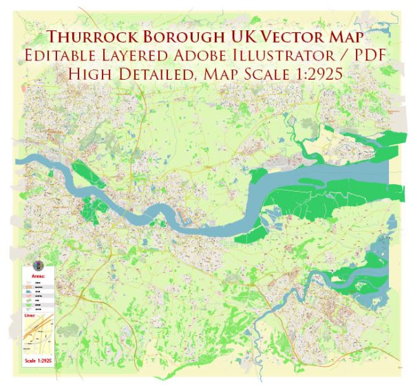
Thurrock is a unitary authority in Essex, England, and is situated on the north bank of the River Thames. It has a range of water resources and bridges that are essential to the local infrastructure and transportation.
- River Thames: Thurrock is located along the north bank of the River Thames. The River Thames is a significant water resource, serving as a vital transportation route for both commercial and leisure purposes. The Thames provides access to London and the North Sea and is used for various activities, including shipping and recreational boating.
- Port of London: The Port of London Authority (PLA) manages the Port of London, which extends through Thurrock. This port is one of the largest and busiest in the United Kingdom, handling a wide range of goods and commodities. It relies heavily on the water resources of the River Thames for shipping and trade.
- Thurrock’s Reservoirs: There are several reservoirs in Thurrock, such as the South Essex Waterworks Company’s reservoirs, which provide freshwater storage for the area. These reservoirs help to ensure a consistent and reliable supply of drinking water to the local community.
- Dartford Crossing: The Dartford Crossing, consisting of the Dartford Tunnel and the Queen Elizabeth II Bridge, connects Thurrock to Kent on the south bank of the River Thames. It is a crucial transport link for the region, facilitating the movement of vehicles and goods between Essex and Kent.
- M25 Motorway: The M25 motorway, one of the busiest motorways in the UK, crosses the River Thames in Thurrock. The Queen Elizabeth II Bridge, as part of the Dartford Crossing, forms a vital section of this motorway network, providing a critical transportation link around London.
- Tilbury Docks: Tilbury Docks are an integral part of Thurrock’s port facilities. They have a long history of trade and commerce and play a key role in handling a variety of cargo, including containers, vehicles, and other goods.
- Thameside Nature Park: This nature park includes various bodies of water, including lagoons, and provides an important habitat for wildlife. It is a resource for environmental and recreational purposes.
- Local Waterways: Thurrock is crisscrossed by various smaller waterways, including canals and streams. These watercourses can have both recreational and ecological significance.
The water resources and bridges in Thurrock are essential for trade, transportation, and the overall infrastructure of the region. They facilitate the movement of people and goods, support industrial and commercial activities, and contribute to the local environment and quality of life.


 Author: Kirill Shrayber, Ph.D.