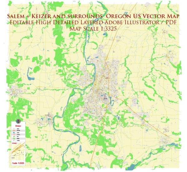
The Salem-Keizer area in Oregon, United States, is served by several water resources and bridges. Salem is the capital city of Oregon, and Keizer is a neighboring city, both located in the Willamette Valley. Here’s some information about the water resources and bridges in the area:
- Willamette River: The Willamette River flows through the Salem-Keizer area. It is a significant water resource for the region, providing water for municipal, industrial, and agricultural purposes. It is also a popular spot for recreational activities like boating and fishing.
- Santiam River: The Santiam River is another important river in the region, and it joins the Willamette River near Salem. The North Santiam River and the South Santiam River are two major tributaries that supply water to the area.
- Stayton Ditch: The Stayton Ditch is an irrigation canal that diverts water from the Santiam River to provide water to agricultural areas around Stayton and other communities in the region.
- Water Treatment Facilities: Both Salem and Keizer have water treatment facilities that ensure the supply of clean and safe drinking water to residents.
Bridges:
- Marion Street Bridge: The Marion Street Bridge is a notable bridge that crosses the Willamette River, connecting downtown Salem with West Salem.
- Center Street Bridge: The Center Street Bridge is another important bridge in Salem, spanning the Willamette River and providing access to downtown Salem and the State Capitol area.
- Keizer Station Boulevard Bridge: This bridge connects Keizer Station and the surrounding commercial areas in Keizer. It plays a significant role in local transportation and commerce.
- Many other smaller bridges and overpasses can be found throughout the Salem-Keizer area, providing transportation and access to different parts of the cities and the surrounding countryside.
These water resources and bridges are essential for the daily functioning of the Salem-Keizer area, serving both practical and recreational purposes while contributing to the region’s infrastructure and development.


 Author: Kirill Shrayber, Ph.D. FRGS