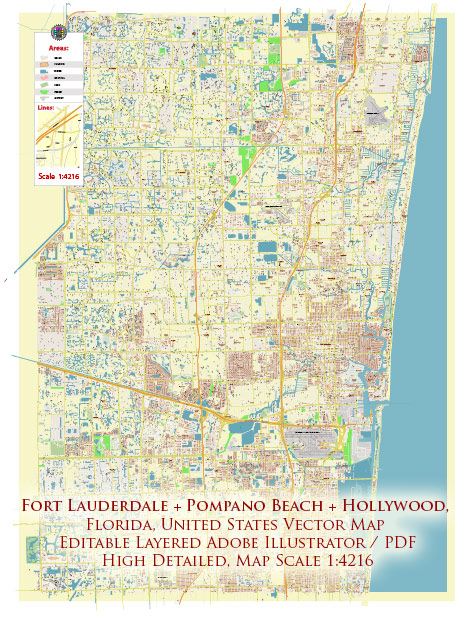
Fort Lauderdale, Pompano Beach, and Hollywood are all located in Broward County, Florida, and they have a variety of water resources and bridges. Here is an overview of the water resources and bridges in these areas:
- Water Resources:
- Intracoastal Waterway: All three cities are situated along the Intracoastal Waterway, a significant water body that runs parallel to the Atlantic Ocean. The Intracoastal Waterway is a popular location for boating, fishing, and waterfront activities.
- Atlantic Ocean: The eastern boundary of these cities is the Atlantic Ocean, providing access to beautiful beaches and a wide range of water activities.
- Canals: Broward County, including these cities, has an extensive network of canals, which are used for flood control and navigation. Many homes in these areas are located on waterfront properties along these canals.
- Bridges:
- Drawbridges: Due to the presence of numerous canals and the Intracoastal Waterway, there are several drawbridges in these cities to allow boats to pass through. Examples include the Las Olas Boulevard drawbridge in Fort Lauderdale and the Atlantic Boulevard drawbridge in Pompano Beach.
- Fixed Bridges: There are also numerous fixed bridges that provide road access over the canals and Intracoastal Waterway. These bridges are essential for maintaining traffic flow in the area.
- Hillsboro Inlet Bridge: The Hillsboro Inlet Bridge connects Pompano Beach to Deerfield Beach and provides access to the Hillsboro Inlet, which is a significant waterway for boaters heading out to the Atlantic Ocean.
- Dania Beach Boulevard Bridge: This bridge connects Dania Beach to Hollywood and provides a route over the Intracoastal Waterway.
- Hollywood Boulevard Bridge: In Hollywood, this bridge is an important road link over the Intracoastal Waterway, connecting the barrier island to the mainland.
These water resources and bridges contribute to the maritime and recreational lifestyle in the area, making it a popular destination for boaters, fishermen, and water enthusiasts. The intricate network of waterways and bridges also plays a vital role in the transportation and connectivity of these cities.


 Author: Kirill Shrayber, Ph.D.