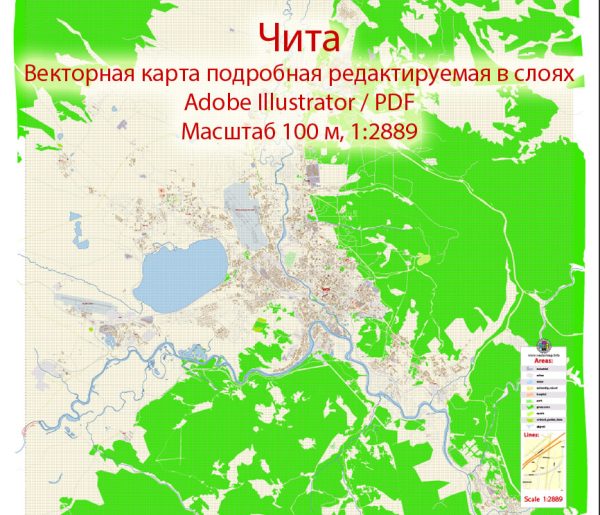
Chita is a city located in the Zabaykalsky Krai region of Russia. It is the administrative center of the Zabaykalsky Krai and is situated in the southeastern part of the country, near the border with Mongolia and China. Chita is known for its rich history and diverse culture. The city is divided into several districts and neighborhoods, each with its own characteristics. Here’s an overview of some of the main districts and neighborhoods in Chita:
- Central District (Tsentralnyy Raion): This is the heart of Chita, where you’ll find the city’s historic and administrative buildings, as well as cultural and shopping centers. The central district is home to Lenin Square, which is surrounded by important landmarks like the Chita Drama Theater and the Transbaikal Regional Museum.
- Sovetsky District (Sovetsky Raion): Located to the east of the central district, Sovetsky is a primarily residential area with a mix of apartment buildings and private homes. It’s a relatively quiet and peaceful part of the city, with some parks and schools.
- Ingodinsky District (Ingodinskiy Raion): Situated to the southwest of the city center, Ingodinsky District is known for its industrial areas and manufacturing facilities. It’s also home to the Chita State University and the Chita State Medical Academy.
- Moskovsky District (Moskovsky Raion): Located to the northwest of the central district, Moskovsky is another residential area with a mix of housing types. It’s a more modern part of the city, with schools, shops, and healthcare facilities.
- Dauria (Dauria): This district lies in the eastern part of Chita and is known for its connection to the Daurian steppe, a vast grassland region. The area is predominantly residential, with some local businesses and green spaces.
- Kalininsky District (Kalininsky Raion): Situated in the south of Chita, Kalininsky District is a mix of residential areas and industrial zones. The Chita Airport is also located in this district, making it a transportation hub for the region.
- Kurortny District (Kurortny Raion): Located to the west of the city center, Kurortny District is known for its natural beauty. It’s home to the Chita Forest Park and several resorts. This area offers opportunities for outdoor activities and relaxation.
- Amur-Nizhneilimsky District (Amur-Nizhneilimsky Raion): Situated to the north of the central district, this area is primarily residential and includes the Chita Botanical Garden, providing green space and recreational opportunities.
Chita is a city with a rich history, and its districts and neighborhoods offer a blend of urban life, residential areas, and natural beauty. Each district has its own unique character and serves the needs of its residents. Please note that the city’s development and characteristics may have changed since my last knowledge update in September 2021, so it’s a good idea to consult local sources for the most up-to-date information about Chita.


 Author: Kirill Shrayber, Ph.D.