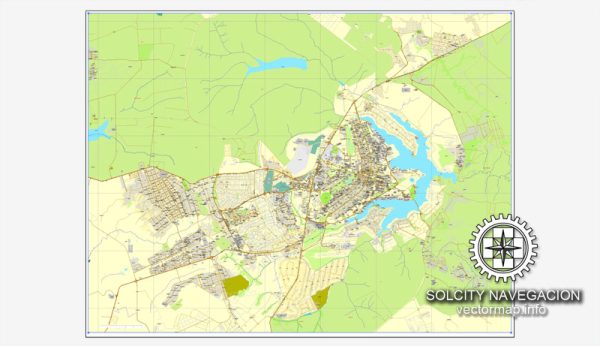
Brasília, the capital city of Brazil, is organized into administrative regions, often referred to as “city districts.” These administrative regions are somewhat different from what is commonly found in other major cities, as Brasília was purposefully designed and built as a planned city in the 1950s. The city’s urban layout is characterized by a unique design that resembles an airplane when viewed from above, and it is divided into several administrative regions or city districts. Here are some of the key city districts in Brasília:
- Plano Piloto: This is the central and most iconic part of Brasília, known for its distinctive urban design. It’s where you’ll find many government buildings, including the presidential palace, the National Congress, and the Supreme Federal Court. The Plano Piloto is organized into various “superblocks” and “quadras,” each with its own number and letter designation.
- Lago Sul and Lago Norte: These two districts are located on the shores of Lake Paranoá, providing residents with beautiful lakefront views. They are known for their upscale neighborhoods, luxurious residences, and recreational areas. Lago Sul is to the south of the lake, while Lago Norte is to the north.
- Cruzeiro: Situated south of Plano Piloto, Cruzeiro is a residential area with a mix of housing options, including apartments and houses. It’s known for its proximity to the city center and ease of access to various amenities.
- Sudoeste/Octogonal: These neighborhoods are located to the southwest of Plano Piloto. Sudoeste is characterized by high-rise buildings and is considered an affluent area. Octogonal is more residential with a variety of housing options, including houses and apartments.
- Guará: Guará is a residential district located to the southeast of Brasília. It offers a mix of housing, including apartments and houses, and is known for its family-friendly atmosphere and amenities.
- Taguatinga: Located to the west of the Plano Piloto, Taguatinga is one of the largest and most populous administrative regions in Brasília. It’s a bustling area with a wide range of commercial and residential developments.
- Ceilândia: This district, situated to the northwest of the Plano Piloto, is one of the most populous and diverse regions in Brasília. It’s known for its vibrant community and cultural diversity.
- Sobradinho: Located to the north of Plano Piloto, Sobradinho is a primarily residential district with a mix of housing options, including apartments and houses. It’s also home to Sobradinho Lake, a popular recreation area.
- Gama: Gama is another administrative region in the southern part of Brasília. It’s known for its residential areas and various recreational facilities.
These are just a few of the administrative regions in Brasília. Each district has its own unique characteristics, offering a diverse range of living and working environments to its residents. The city’s planned layout and efficient design make it a distinctive and iconic urban center in Brazil.


 Author: Kirill Shrayber, Ph.D. FRGS