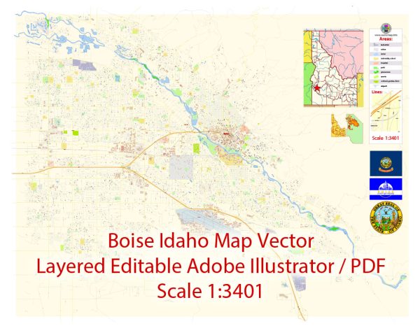
Boise, the capital city of Idaho, is divided into several distinct districts and neighborhoods, each with its own unique characteristics and attractions. Here’s a brief description of some of the main districts in Boise:
- Downtown Boise: This is the heart of the city and features a mix of business, entertainment, and cultural hubs. You’ll find the Idaho State Capitol, numerous restaurants, shops, and theaters here. The Grove Plaza is a central gathering spot, and you can explore the vibrant nightlife along 8th Street.
- North End: Known for its tree-lined streets, historic homes, and a strong sense of community, the North End is a charming and sought-after residential neighborhood. Hyde Park, at the center of the North End, offers boutique shops and dining.
- East End: This area is adjacent to downtown and boasts a mix of historic and modern homes. The Boise River Greenbelt and Warm Springs Golf Course are nearby, providing outdoor recreational opportunities.
- Boise Bench: Located on a high plateau south of downtown, the Bench offers views of the city and the Boise Foothills. It’s a diverse area with a mix of housing, parks, and shopping centers.
- West Boise: This district features a variety of residential neighborhoods and parks, including the popular Ann Morrison Park. The Westgate Shopping Center is a major retail hub.
- Southeast Boise: This area includes the Barber Valley and Harris Ranch neighborhoods, which are newer residential developments. The Boise River runs through this district, providing opportunities for outdoor activities.
- South Boise Village: Known for its agricultural history, this area has experienced growth and development in recent years. It’s home to the Western Idaho Fairgrounds and the expansive, multi-use Expo Idaho complex.
- Northwest Boise: This district includes the Hidden Springs and Avimor communities, offering a mix of suburban and rural living. The nearby Boise National Forest provides ample outdoor recreation options.
- Southwest Boise: This district features a blend of residential areas and farmland. It’s known for its rural character, but new developments have added housing options to the mix.
- Harris Ranch: A modern and well-planned community located in the eastern part of Boise, it’s known for its eco-friendly design, trails, and proximity to the Boise River.
- Boise State University (BSU): Surrounding the university campus, this area is a mix of student housing, apartments, and businesses catering to the college community. It’s also home to the Boise State Broncos.
- Boise Foothills: Not a district in the traditional sense, the Boise Foothills are a natural area north of the city. They offer hiking and mountain biking trails with stunning views of the city and surrounding mountains.
Boise’s districts offer a diverse range of lifestyles and experiences, from the vibrant urban core to peaceful residential neighborhoods and natural escapes. Each area has its own unique charm, making Boise a city with something for everyone.


 Author: Kirill Shrayber, Ph.D. FRGS