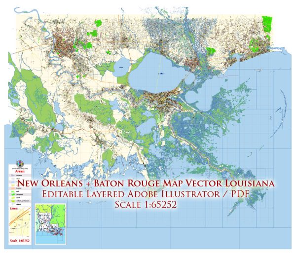
Baton Rouge and New Orleans, both located in the state of Louisiana, have significant water resources and a network of bridges due to their proximity to major water bodies. Here’s an overview of their water resources and bridges:
Baton Rouge:
- Mississippi River: Baton Rouge is situated on the eastern bank of the Mississippi River, one of the largest and most important rivers in the United States. The river serves as a crucial water resource for transportation, commerce, and recreation in the region.
- Atchafalaya River: The Atchafalaya River, which flows southwest of Baton Rouge, is another vital waterway in the region. It plays a crucial role in managing the flow of the Mississippi River, reducing flood risk, and supporting a diverse ecosystem.
- Bridges: Baton Rouge has several significant bridges that cross the Mississippi River, providing vital transportation links between the eastern and western banks. These include the Horace Wilkinson Bridge (I-10), the Huey P. Long Bridge, and the John James Audubon Bridge.
New Orleans:
- Mississippi River: New Orleans is located along the banks of the Mississippi River and is a major port city, making it a key player in the transportation of goods up and down the river. The river is integral to the city’s economy and culture.
- Lake Pontchartrain: To the north of New Orleans is Lake Pontchartrain, a large brackish estuary. The lake and its surrounding wetlands are essential to the area’s ecology and provide a valuable water resource.
- Bridges: New Orleans has numerous bridges that span the Mississippi River, connecting the city with its suburbs and the western bank of the river. Notable bridges include the Crescent City Connection (CCC), the Huey P. Long Bridge, and the new Mississippi River Bridge.
Both cities rely on their water resources for various purposes, including transportation, industry, and recreation. The extensive bridge network in these areas is critical for maintaining accessibility and connectivity across the rivers and water bodies, facilitating the movement of people and goods in the region.


 Author: Kirill Shrayber, Ph.D. FRGS