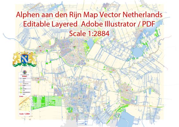
Alphen aan den Rijn is a city in the Netherlands located in the province of South Holland. It is situated along the Oude Rijn (Old Rhine) river, which plays a significant role in the city’s water resources and transportation infrastructure. Here are some key points about Alphen aan den Rijn’s water resources and bridges:
- Oude Rijn River: The Oude Rijn River flows through Alphen aan den Rijn, dividing the city into two parts. The river is a branch of the Rhine River and is a historically important waterway for transportation and trade.
- Canals and Waterways: Alphen aan den Rijn has a network of canals and waterways that connect to the Oude Rijn. These canals play a role in the city’s drainage and water management.
- Bridges: Alphen aan den Rijn features numerous bridges that span the Oude Rijn and other waterways. These bridges are essential for connecting different parts of the city and facilitating transportation. Some notable bridges include:
- Alphense Brug: This is a major bridge that crosses the Oude Rijn and connects the two sides of the city. It is a vital transportation link.
- Swaenswijkbrug: Another important bridge that connects various neighborhoods within the city.
- Maximabrug: This is a modern cable-stayed bridge over the Oude Rijn, completed in 2016. It is named after Queen Máxima of the Netherlands.
- Water Management: Like many cities in the Netherlands, Alphen aan den Rijn has a sophisticated water management system to control water levels and prevent flooding. The city’s location in a low-lying area makes it susceptible to water-related challenges, and these systems are crucial for safeguarding against such risks.
- Watersports and Recreation: The Oude Rijn River and the various canals offer opportunities for water-based recreational activities, including boating and watersports.
Overall, Alphen aan den Rijn’s water resources and bridges are central to its identity and transportation infrastructure, reflecting the Netherlands’ historical relationship with water management and trade. The presence of these waterways and bridges also adds to the city’s charm and provides residents with scenic and recreational opportunities.


 Author: Kirill Shrayber, Ph.D.