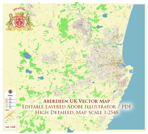
Aberdeen, located in Scotland, United Kingdom, is divided into several districts and neighborhoods. Here are some of the key districts and areas within the city:
- City Centre: This is the heart of Aberdeen and contains the main shopping areas, restaurants, bars, and cultural attractions. The city center is home to Union Street, which is the primary shopping thoroughfare.
- Old Aberdeen: Situated north of the city center, Old Aberdeen is home to the University of Aberdeen. It is a historic area with beautiful architecture, cobbled streets, and the impressive King’s College building.
- Rosemount: Located to the northwest of the city center, Rosemount is a residential area with a village-like atmosphere. It has many independent shops and cafes.
- Torry: Situated on the southern bank of the River Dee, Torry is a former fishing village that has now been absorbed into the city. It offers great views of the harbor and is home to the Torry Battery, a historic coastal artillery fort.
- Dyce: This district is to the northwest of the city and is known for Aberdeen International Airport. It is a primarily residential area with good transportation links to the city center.
- Bridge of Don: Located to the north of the city, Bridge of Don is a residential area with various amenities and is known for its proximity to the beach. It has retail parks, schools, and parks.
- Cults: A suburb in the western part of Aberdeen, Cults is an affluent area with a village feel. It’s known for its good schools and attractive housing.
- Mastrick: Situated to the west of the city center, Mastrick is a residential area with several schools, parks, and shopping facilities.
- Kincorth: Located to the south of the River Dee, Kincorth is a residential area with schools, shopping facilities, and recreational areas.
- Milltimber: A suburb to the west of the city, Milltimber is known for its large, upscale homes and is a popular residential area.
- Mannofield: Situated to the west of the city center, Mannofield is a residential area with good schools and parks.
These are some of the main districts and neighborhoods in Aberdeen, each with its own unique character and amenities. The city offers a range of housing options, from bustling city center apartments to quiet suburban homes.


 Author: Kirill Shrayber, Ph.D. FRGS