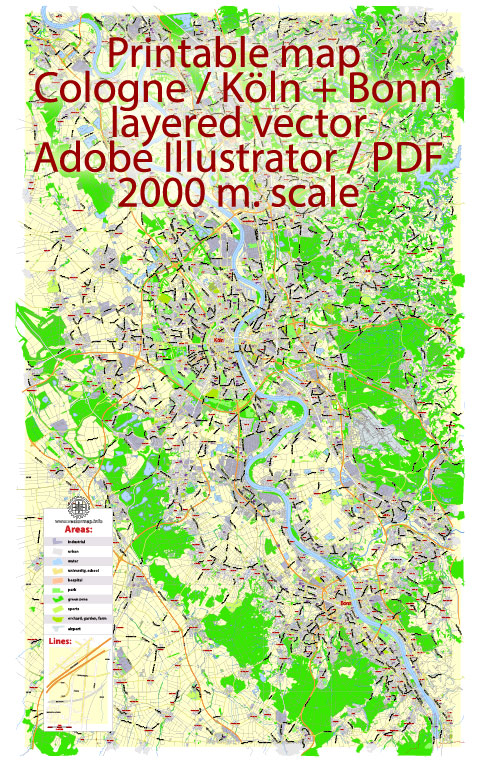
Cologne (Köln) and Bonn are two cities in Germany located along the Rhine River, and they have access to water resources and various bridges. Here is some information about the water resources and bridges in these cities:
Water Resources:
- The Rhine River: The Rhine River is one of the major water resources in the region. It flows through both Cologne and Bonn, providing water for various purposes, including transportation, recreation, and industrial use.
- The River Sieg: The River Sieg is another significant waterway that flows into the Rhine near Bonn. It is a tributary of the Rhine and contributes to the water resources in the area.
- Groundwater: Both cities rely on groundwater for their water supply. The groundwater is extracted and treated for drinking water and various other uses.
Bridges:
- Hohenzollern Bridge (Hohenzollernbrücke): This iconic bridge spans the Rhine River in Cologne. It is a vital transportation link, serving both pedestrians and trains. The bridge is well-known for its love locks, where couples attach padlocks to the railing as a symbol of their love.
- Severins Bridge (Severinsbrücke): Another significant bridge in Cologne, Severins Bridge connects the city center with the district of Deutz. It is used by both pedestrians and vehicles.
- Kennedy Bridge (Kennedybrücke): This bridge, also in Cologne, is a crucial road connection across the Rhine. It is named after U.S. President John F. Kennedy.
- Nordbrücke: The Nordbrücke is a bridge in Bonn that crosses the Rhine River. It is an essential transportation link connecting different parts of the city.
- Südbrücke: The Südbrücke, also located in Bonn, is another bridge that spans the Rhine. It plays a significant role in the city’s transportation network.
Both Cologne and Bonn have a network of smaller bridges and pedestrian walkways that help people cross the rivers and canals within the cities. The Rhine River, in particular, is a vital waterway in the region, serving as a transportation route, a source of water, and a scenic feature for residents and visitors.


 Author: Kirill Shrayber, Ph.D.