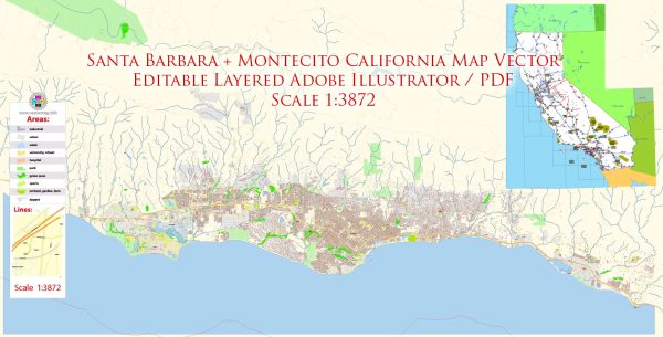
Santa Barbara and Montecito, California, are beautiful coastal communities with several principal streets and avenues. Here are some of the main streets in these areas:
Santa Barbara:
- State Street: State Street is one of the primary streets in downtown Santa Barbara and is known for its shopping, dining, and cultural attractions.
- Cabrillo Boulevard: This scenic waterfront street runs along the Pacific Ocean and offers stunning views of the beach, the harbor, and the Santa Ynez Mountains.
- Milpas Street: Located in the eastern part of Santa Barbara, Milpas Street is a hub for local businesses, restaurants, and shops.
- Chapala Street: Chapala Street runs parallel to State Street and offers a variety of restaurants, shops, and residences.
- Anacapa Street: Anacapa Street is another popular downtown street, known for its boutiques, art galleries, and dining options.
Montecito:
- Coast Village Road: This charming street in Montecito is lined with upscale boutiques, cafes, and restaurants. It’s a popular destination for shopping and dining.
- San Ysidro Road: San Ysidro Road is a scenic road that winds through the hills of Montecito, passing by beautiful estates and offering picturesque views of the area.
- East Valley Road: East Valley Road is another important road in Montecito, home to both residential properties and some local businesses.
- Hot Springs Road: Hot Springs Road runs through Montecito and provides access to some of the local hot springs, resorts, and hiking trails.
- Olive Mill Road: Olive Mill Road intersects Coast Village Road and provides access to the beach, shopping, and dining options.
These streets are just a few of the notable ones in Santa Barbara and Montecito. Each street offers a unique experience, from the vibrant downtown of Santa Barbara to the upscale and picturesque neighborhoods of Montecito.


 Author: Kirill Shrayber, Ph.D. FRGS