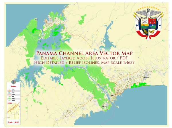
The Panama Canal is a man-made waterway that connects the Atlantic Ocean to the Pacific Ocean through the Isthmus of Panama in Central America. Its construction and history are significant in terms of engineering, commerce, and geopolitics. Here is an overview of the history of the Panama Canal:
- Early Proposals: The idea of a canal through the Isthmus of Panama dates back to the early 16th century when Spanish explorers and colonial officials recognized the potential benefits of such a passage. Various proposals were made over the centuries, but the challenges of the rugged terrain and disease (particularly malaria and yellow fever) hindered progress.
- French Attempts: In the late 19th century, the French engineer Ferdinand de Lesseps, who had successfully built the Suez Canal in Egypt, attempted to build a canal across Panama. However, the project faced numerous difficulties, including the high mortality rate among workers due to tropical diseases and landslides. The French venture eventually went bankrupt.
- U.S. Involvement: In the early 20th century, the United States expressed interest in constructing the canal. The U.S. government purchased the assets and rights of the French canal company, and under the leadership of engineers like John F. Stevens and George W. Goethals, they undertook an ambitious project.
- Construction: The construction of the Panama Canal began in 1904. It was a massive engineering feat that involved digging a 50-mile (80-kilometer) long canal through dense jungle, as well as creating a system of locks to raise and lower ships to the level of the canal.
- Challenges: The construction of the canal was fraught with challenges, including the need to control disease, mudslides, and the transportation of workers and materials. The chief factors contributing to the high death toll among workers were the harsh living conditions, long working hours, and the prevalence of malaria and yellow fever.
- Completion: The canal was officially opened on August 15, 1914, with the passage of the SS Ancon, marking the completion of one of the most ambitious engineering projects in history.
- U.S. Control: The United States maintained control of the Panama Canal for most of the 20th century. The terms of the Hay-Bunau-Varilla Treaty allowed the U.S. to oversee the operation and management of the canal until the Torrijos-Carter Treaties in 1977.
- Handover to Panama: The Torrijos-Carter Treaties led to the gradual transfer of control of the canal to Panama. On December 31, 1999, Panama officially took over the operation and administration of the canal.
- Expansion: In the early 21st century, Panama undertook a significant expansion project known as the Panama Canal Expansion or the “Panama Canal Expansion Project.” It involved the construction of new, larger locks to accommodate modern, larger vessels known as “New Panamax” or “Neo-Panamax” ships. This expansion was completed in 2016, significantly increasing the canal’s capacity and allowing for the transit of larger container ships and tankers.
The Panama Canal remains a vital conduit for global trade, significantly reducing the time and distance needed for ships to travel between the Atlantic and Pacific Oceans. It plays a crucial role in the movement of goods and commodities and has had a lasting impact on the economic development and geopolitical dynamics of the Americas and the world.


 Author: Kirill Shrayber, Ph.D. FRGS