City Plan Map Texas State US

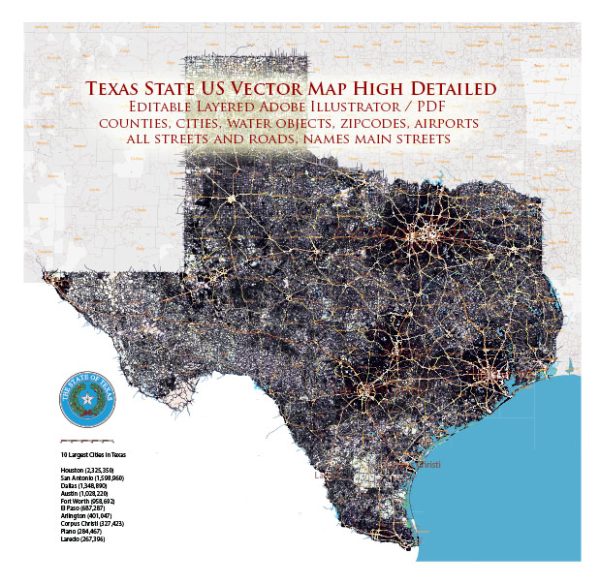
Map — Map Texas State US

An editable map of Map Texas State US designed as a dependable base for print and digital layouts. Waterfronts and parks receive extra separation for better contrast on light palettes. District and neighborhood labels are arranged to avoid collisions around dense cores. Coordinates and scales are prepared for sheet production and consistent exports. Bridges, tunnels and ferry lines are isolated so routes remain legible after recolor. Layer structure separates arterials and locals, districts, hydrography, parks and landmarks.

Use it for visitor guides, city infographics, investment decks and municipal communications. Saves prepress time by reducing manual fixes and keeping the visual system consistent. Color systems can be swapped quickly to match seasonal or brand variants. Keeps labels readable while allowing deep customization of routes and highlights. Legibility holds up on handheld leaflets and large lobby posters alike.

Texas is a large state in the United States with numerous cities, towns, and municipalities. Here is a list of some of the major cities and towns in Texas:

Major Cities in Texas:

  1. Houston
  2. San Antonio
  3. Dallas
  4. Austin
  5. Fort Worth
  6. El Paso
  7. Arlington
  8. Corpus Christi
  9. Plano
  10. Laredo
  11. Lubbock
  12. Garland
  13. Irving
  14. Amarillo
  15. Grand Prairie
  16. McKinney
  17. Frisco
  18. Brownsville
  19. Pasadena
  20. Killeen

Other Notable Cities and Towns in Texas:

  1. Waco
  2. Denton
  3. Midland
  4. Abilene
  5. Odessa
  6. Round Rock
  7. Wichita Falls
  8. College Station
  9. Pearland
  10. Richardson
  11. Sugar Land
  12. Beaumont
  13. Lewisville
  14. Tyler
  15. League City
  16. San Angelo
  17. Allen
  18. Edinburg
  19. Mission
  20. Bryan

These are just a few of the cities and towns in Texas. The state is known for its diverse and vibrant communities, and each city and town has its unique characteristics and attractions.

Author: Kirill Shrayber, Ph.D.

I have been working with vector cartography for over 25 years, including GPS, GIS, Adobe Illustrator and other professional cartographic software.
Linkedin: https://www.linkedin.com/in/kirill-shrayber-0b839325/
Twitter: https://twitter.com/vectormapper

Are we missing some maps? Let us know!!!
What map do you need?

    We will upload it within the next 24 hours and notify you by Email.

    Menu