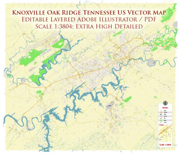
Knoxville and Oak Ridge, Tennessee, have a reasonably well-developed transportation system that includes various modes of transportation to facilitate the movement of people and goods within the region. Here’s an overview of the transport system in these areas:
- Road Transportation:
- Interstate Highways: Knoxville is a major transportation hub in East Tennessee. It is served by several important highways, including Interstate 40 (I-40) and Interstate 75 (I-75). These highways connect Knoxville to major cities like Nashville, Chattanooga, and Cincinnati.
- State Highways: Tennessee State Route 162, also known as Pellissippi Parkway, is a significant state route that connects Oak Ridge to Knoxville. It provides easy access to Oak Ridge National Laboratory and the Y-12 National Security Complex.
- Local Roads: There are well-maintained local roads in both Knoxville and Oak Ridge, making it convenient for local commuting.
- Public Transportation:
- Knoxville Area Transit (KAT): Knoxville has a public bus system operated by KAT. This bus service offers several routes within the city and its suburbs, including Oak Ridge.
- ORNL Shuttle: Oak Ridge National Laboratory operates a shuttle service that connects Oak Ridge with Knoxville and other key destinations in the area. This service primarily serves the employees and contractors of the laboratory.
- Rail Transportation:
- Knoxville is served by several major railroads, which are essential for freight transportation in the region. These railroads connect the area to other major cities and ports.
- Air Transportation:
- McGhee Tyson Airport: McGhee Tyson Airport is the main commercial airport serving the Knoxville metropolitan area. It’s located about 12 miles south of downtown Knoxville. The airport offers both domestic and limited international flights, making it a significant transportation hub for the region.
- Cycling and Walking:
- Both Knoxville and Oak Ridge have been working to improve their cycling infrastructure with the addition of bike lanes and walking paths. Knoxville has several greenways and trails, like the Neyland Greenway and Third Creek Greenway, for recreational purposes.
- Private Vehicle and Taxis:
- Like in most cities, private vehicles and taxis are readily available for transportation within Knoxville and Oak Ridge.
- Ridesharing Services: Companies like Uber and Lyft operate in the Knoxville and Oak Ridge areas, providing additional options for getting around.
- Car Rental Services: Various car rental agencies have a presence in these areas, offering rental vehicles for those who need them.
- Freight and Cargo Transportation: The region has a well-developed freight and cargo transportation network, including trucking and shipping services, given the importance of the area for industry and commerce.
The transport system in Knoxville and Oak Ridge is designed to accommodate the needs of residents, commuters, and visitors, and it’s continually evolving to meet the growing demands of the region.


 Author: Kirill Shrayber, Ph.D.