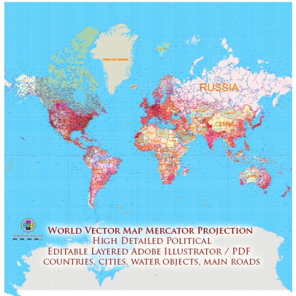
The World Mercator projection is a cylindrical map projection that was developed by Gerardus Mercator in the 16th century. It is one of the most well-known and widely used map projections, especially for nautical navigation. The key features of the World Mercator projection are as follows:
- Conformal Projection: The Mercator projection is conformal, which means it preserves angles locally. This property ensures that shapes of small features like countries and coastlines are accurately represented. It’s particularly useful for navigation because it allows sailors to draw a straight line on the map that corresponds to a constant compass bearing.
- Straight Meridians and Parallels: On a Mercator map, both meridians (lines of longitude) and parallels (lines of latitude) are depicted as straight, evenly spaced, and perpendicular to each other. This grid of straight lines makes navigation and measurement relatively straightforward.
- Constant Direction: A key feature of the Mercator projection is that all lines of constant compass bearing (rhumb lines) appear as straight lines on the map. This is why it’s widely used in navigation, as sailors can plot a course as a straight line on the map, and it corresponds to a constant direction.
- Distortion: One significant drawback of the Mercator projection is that it introduces significant distortion in terms of area and distance, especially as you move away from the equator. Areas near the poles are greatly exaggerated in size. Greenland, for example, appears much larger than it actually is.
- Greenland Mercator Effect: This projection has been criticized for its exaggeration of land areas in high latitudes. It’s often referred to as the “Greenland Mercator Effect” because Greenland, in particular, appears much larger on a Mercator map than it is in reality.
- Limited to Low and Mid-Latitudes: The Mercator projection is best suited for low and mid-latitudes and becomes increasingly problematic near the poles. It’s not suitable for representing polar regions accurately.
- Navigation and Exploration: Despite its limitations, the Mercator projection remains a popular choice for navigation charts, particularly for maritime use. It has also played a significant historical role in early world exploration and mapmaking.
- Historical Significance: Gerardus Mercator’s creation of this projection was a significant advancement in cartography and played a crucial role in the Age of Exploration. It allowed for more accurate navigation and charting of new territories.
In summary, the World Mercator projection is known for its conformal nature, which makes it valuable for navigation. However, it introduces distortion in terms of area and is not suitable for representing polar regions accurately. Its historical significance and practical applications in navigation make it an enduring and well-recognized map projection.


 Author: Kirill Shrayber, Ph.D.