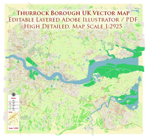
Thurrock is a unitary authority and borough in Essex, England, United Kingdom. It is located to the east of London, along the northern bank of the River Thames. Thurrock is known for its diverse mix of urban and rural areas, as well as its proximity to London, making it an attractive place for commuters. Here are some key points about Thurrock:
- Location: Thurrock is situated in the East of England, and it shares its borders with Essex to the north and east, the River Thames to the south, and Greater London to the west.
- Urban Centers: The borough includes several towns and settlements, including Grays, Tilbury, Purfleet, Stanford-le-Hope, and South Ockendon. Grays is the largest town and serves as the administrative center of the borough.
- History: Thurrock has a rich history, with evidence of human habitation dating back to Roman times. It played an important role in maritime and industrial activities along the Thames.
- Economy: The local economy is diverse and includes industries such as logistics, distribution, manufacturing, and retail. The borough’s proximity to major transport links, including the Port of Tilbury, has contributed to its economic significance.
- Port of Tilbury: The Port of Tilbury, located on the River Thames, is one of the UK’s major ports and is a significant driver of economic activity in Thurrock. It handles various cargo types, including containers, bulk cargo, and roll-on/roll-off (RoRo) traffic.
- Shopping and Culture: Lakeside Shopping Centre, one of the largest shopping centers in Europe, is located in Thurrock. The borough also has cultural and leisure facilities, including the Thameside Theatre, Coalhouse Fort, and parks.
- Education: Thurrock is home to several primary and secondary schools, as well as further education institutions. South Essex College, for example, provides a range of educational opportunities.
- Transportation: Thurrock has good transportation links, including the M25 motorway, A13 road, and proximity to London via the C2C railway line. The London Gateway container terminal is also situated in the borough.
- Nature and Green Spaces: Despite its urban areas, Thurrock features natural beauty spots, such as the Thurrock Thameside Nature Park, which offers opportunities for birdwatching and outdoor activities.
- Governance: Thurrock is a unitary authority, which means it has its own local council responsible for providing a range of public services, including education, housing, and transportation.


 Author: Kirill Shrayber, Ph.D. FRGS