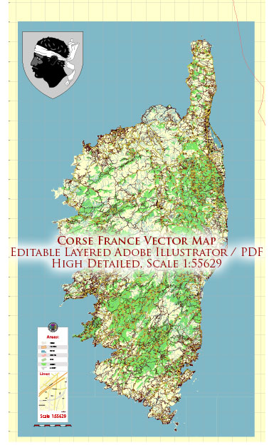
Corsica, a beautiful island located in the Mediterranean Sea, has a network of roads that provide access to various regions and destinations on the island. The road system in Corsica consists of a network of highways, regional roads, and smaller local roads. Here’s an overview of the road system in Corsica:
- Main Highways (Routes Nationales):
- RN193: This is the main highway that connects the northern and southern parts of Corsica. It runs from Bastia in the north to Bonifacio in the south.
- RN196: This road connects Ajaccio in the west to Solenzara in the east.
- RN197: It connects Ghisonaccia to Porto-Vecchio.
- Regional Roads (Routes Départementales):
- Corsica has an extensive network of regional roads (RD) that cover the island. These roads provide access to various towns, villages, and tourist destinations.
- Mountain Roads:
- Corsica is known for its mountainous terrain, and there are numerous roads that wind through the mountains. These roads can be quite narrow and winding, so drivers should exercise caution, especially in challenging weather conditions.
- Coastal Roads:
- Corsica offers some stunning coastal drives along the Mediterranean Sea. These roads provide access to picturesque beaches and villages.
- Interior Roads:
- There are many roads that traverse the interior of the island, providing access to Corsica’s rugged and beautiful interior landscapes.
- Toll Roads:
- Corsica does not have any toll roads, so you won’t need to pay tolls to use the highways or other roads on the island.
- Traffic and Road Conditions:
- Traffic can be heavy during the peak summer tourist season, especially on the main highways and coastal roads. It’s advisable to plan your travel accordingly.
- The road conditions can vary, with some smaller roads being narrow and winding. Be prepared for some steep and challenging terrain, especially in the mountainous areas.
- Road Signs:
- Road signs in Corsica are typically in French, but many also include Corsican. It’s a good idea to familiarize yourself with common road signs and their meanings before driving on the island.
- Public Transportation:
- In addition to the road system, Corsica has a regional train network and a network of buses that provide public transportation across the island.
- Ferries:
- To access Corsica, many visitors arrive by ferry, especially from the French mainland and neighboring islands. The major ports of entry are Bastia, Ajaccio, Calvi, and Porto-Vecchio.
When traveling in Corsica, it’s important to be well-prepared and to pay attention to road conditions, especially in the more remote areas. Additionally, driving in Corsica can be quite different from mainland France, so be aware of local driving customs and take care when navigating the island’s roads.


 Author: Kirill Shrayber, Ph.D.