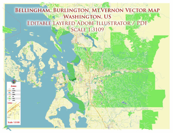
Bellingham, Washington, has a road system that supports the city and the surrounding region. The road infrastructure is well-maintained and organized to facilitate transportation within the city and connect it to other parts of Whatcom County and the Pacific Northwest. Here are some key features of the road system in Bellingham:
- Interstate 5 (I-5): Bellingham is directly connected to the Interstate 5 corridor, which is a major north-south highway running from the Canadian border to the Mexican border. I-5 provides quick access to Seattle to the south and Vancouver, British Columbia, to the north.
- State Routes: Several state routes intersect in Bellingham or pass through the city, including:
- Washington State Route 542 (SR 542): This route leads to Mount Baker and the Mount Baker Ski Area, providing access to outdoor recreational activities in the area.
- Washington State Route 539 (SR 539): Also known as the Guide Meridian, this road connects Bellingham to Lynden and the Canadian border to the north.
- Washington State Route 11 (SR 11): This route, known as Chuckanut Drive, offers scenic coastal views and connects Bellingham to Skagit County to the south.
- City Streets: Bellingham has a grid-based street system with numbered streets running east-west and lettered streets running north-south. The city’s streets are well-maintained and provide easy navigation within the city.
- Public Transportation: Bellingham also has a public transportation system, including buses operated by Whatcom Transportation Authority (WTA). WTA provides regular bus services within the city and to nearby communities.
- Biking and Pedestrian Infrastructure: Bellingham is known for its pedestrian and bike-friendly infrastructure. The city has bike lanes, walking paths, and dedicated bike trails, making it accessible for cyclists and pedestrians.
- Ferries: While not part of the road system, it’s worth noting that Bellingham is also served by the Alaska Marine Highway System, with ferry service to Alaska. This offers an alternative transportation option for those traveling to or from Alaska.
- Infrastructure Projects: Bellingham, like many cities, undergoes road infrastructure projects to improve and maintain its roadways. These projects include road resurfacing, intersection improvements, and safety enhancements.
- Traffic and Congestion: Bellingham experiences traffic congestion, particularly during peak commuting hours and during the summer tourist season when visitors come to enjoy the natural attractions in the region. Local authorities work to address traffic flow and safety issues through traffic management and infrastructure improvements.
The road system in Bellingham is designed to accommodate the transportation needs of residents, tourists, and businesses. It provides connections to major highways, access to outdoor recreational areas, and a well-structured city grid to facilitate local movement. As with any city, travelers should stay updated on road conditions, construction projects, and traffic advisories when planning their routes.


 Author: Kirill Shrayber, Ph.D.