Editable Vector Map of the Winterthur Switzerland in SVG format.
Can be edited in the following programs: Adobe Illustrator, CorelDraw, InkScape
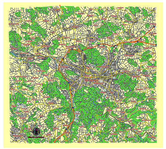
Principal streets and roads, names places, residential streets and roads, road number labels, water objects, land use areas.
Winterthur Switzerland editable vector map svg free
DOWNLOAD ARCHIVE FOR FREE >>>
Distributed with Creative Commons CC-Zero = Creative Commons CC0 1.0 Universal Public Domain Dedication International License
SEE ALSO FULL VERSION OF THE Winterthur Switzerland vector map (Adobe Illustrator, PDF etc.)
Winterthur is a city in Switzerland known for its cultural richness and industrial heritage. Here are some of its principal streets, roads, and city districts:
Streets and Roads:
- Stadthausstrasse: A central street known for shopping and dining.
- Marktgasse: Another important street with historical buildings and shops.
- Obertor: Leads to the Obertorplatz, a central square.
- Technikumstrasse: Connects various parts of the city and is known for educational institutions.
- Römerstrasse: Runs through several residential and commercial areas.
- Zürcherstrasse: A major road leading towards Zürich.
City Districts (Stadtteile):
- Altstadt: The historic old town with narrow streets and medieval architecture.
- Lind: Known for its residential areas and parks.
- Wülflingen: A district with a mix of residential and industrial zones.
- Seen: Located around Lake Wintertur, offering recreational areas and residential options.
- Veltheim: Features green spaces and residential neighborhoods.
- Töss: Known for its industrial heritage and diverse community.
Other Notable Locations:
- Winterthur Hauptbahnhof: The main railway station, a hub for transportation.
- Technorama: A famous science and technology museum.
- Swiss Science Center Technorama: Another prominent science museum.
- Villa Flora: A historic villa and cultural center.
These streets, roads, and districts highlight the diverse character of Winterthur, blending historical charm with modern amenities and industrial innovation.
 Author: Kirill Shrayber, Ph.D. FRGS