Editable Vector Map of the Saint Petersburg Russia in SVG, PDF and Adobe Illustrator format.
Can be edited in the following programs: Adobe Illustrator, CorelDraw, InkScape
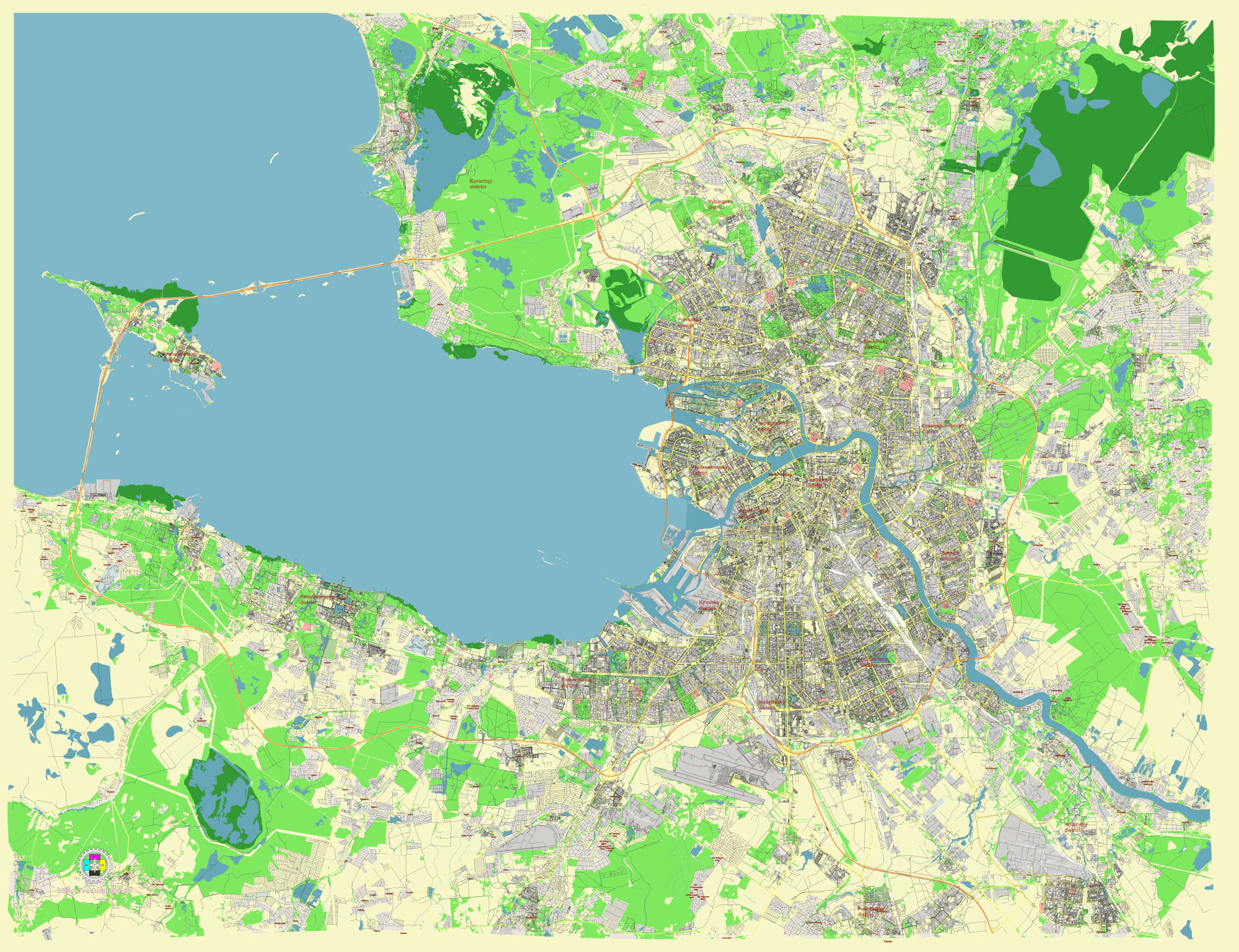
Principal streets and roads, names places, residential streets and roads, road number labels, water objects, land use areas.
Saint Petersburg Russia editable vector map svg, pdf, ai (ENG) free
Saint Petersburg Russia editable vector map SVG free DOWNLOAD ARCHIVE 16 mb FOR FREE >>>
Saint Petersburg Russia editable vector map PDF free DOWNLOAD ARCHIVE 43 mb FOR FREE >>>
Saint Petersburg Russia editable vector map Ai free DOWNLOAD ARCHIVE 24 mb FOR FREE >>>
Distributed with Creative Commons CC-Zero = Creative Commons CC0 1.0 Universal Public Domain Dedication International License
SEE ALSO FULL VERSION OF THE Saint Petersburg Russia vector map (Adobe Illustrator, PDF etc.)
Saint Petersburg, Russia, is known for its grand architecture, historic sites, and an extensive network of streets, roads, and city districts. Here’s an overview:
Principal Streets and Roads:
- Nevsky Prospect:
- The main thoroughfare of the city, lined with historic buildings, shops, cafes, and cultural landmarks.
- Connects the Admiralty and the Alexander Nevsky Lavra.
- Ligovsky Prospect:
- Runs parallel to Nevsky Prospect and is another major street in the city.
- Known for shopping centers, restaurants, and hotels.
- Moskovsky Prospect:
- A major radial avenue running south from the city center.
- Connects to the Pulkovo Airport and is lined with Stalinist architecture.
- Sadovaya Street:
- Located in the central part of the city, it connects various historic neighborhoods.
- Notable for the Haymarket area and several markets.
- Vasilievsky Island’s Major Roads:
- Bolshoi Prospekt, Maly Prospekt, and Sredny Prospekt are the principal avenues.
- These roads are key for accessing the island’s numerous educational and cultural institutions.
Principal City Districts:
- Central District:
- The heart of Saint Petersburg, encompassing many of its most famous landmarks, including the Hermitage Museum, Kazan Cathedral, and the Church of the Savior on Spilled Blood.
- Known for its historic architecture and vibrant cultural scene.
- Admiralteysky District:
- Home to the Admiralty building, St. Isaac’s Cathedral, and the Mariinsky Theatre.
- A district rich in history and culture.
- Vasileostrovsky District:
- Located on Vasilievsky Island, it includes the historic Twelve Colleges building, now part of Saint Petersburg State University.
- Known for its academic institutions and cultural sites.
- Petrogradsky District:
- Known for the Peter and Paul Fortress, which is the historic core of the city.
- Features the Saint Petersburg Botanical Garden and several notable museums.
- Nevsky District:
- Includes residential areas and industrial zones.
- Known for its large parks and green spaces.
- Moskovsky District:
- Named after the main avenue that runs through it, Moskovsky Prospect.
- Features Stalinist architecture and the expansive Victory Park.
- Kalininsky District:
- A predominantly residential area with several parks.
- Home to the Saint Petersburg State Polytechnical University.
Saint Petersburg is renowned for its orderly grid of streets and canals, reminiscent of European cities like Amsterdam and Venice. Each district and major road has its own unique character and historical significance, contributing to the city’s rich cultural tapestry.
 Author: Kirill Shrayber, Ph.D. FRGS