Editable Vector Map of the Rotterdam Netherlands in SVG format.
Can be edited in the following programs: Adobe Illustrator, CorelDraw, InkScape
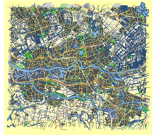
Principal streets and roads, names places, residential streets and roads, road number labels, water objects, land use areas.
Rotterdam Netherlands editable vector map svg free
DOWNLOAD ARCHIVE FOR FREE >>>
Distributed with Creative Commons CC-Zero = Creative Commons CC0 1.0 Universal Public Domain Dedication International License
SEE ALSO FULL VERSION OF THE Rotterdam Netherlands vector map (Adobe Illustrator, PDF etc.)
Rotterdam, one of the major cities in the Netherlands, is known for its modern architecture and bustling urban life. Here’s an overview of some of the principal streets, roads, and city districts in Rotterdam:
Principal Streets and Roads
- Coolsingel: One of Rotterdam’s most famous streets, Coolsingel is a major thoroughfare running through the city center. It’s home to the iconic City Hall and several important landmarks.
- Lijnbaan: Known as the first car-free shopping street in the world, Lijnbaan is a key shopping area in Rotterdam with numerous stores, restaurants, and cafes.
- Witte de Withstraat: A vibrant street filled with art galleries, trendy bars, and eclectic shops, Witte de Withstraat is a cultural hotspot in Rotterdam.
- Westersingel: This scenic street runs alongside a canal and is known for its beautiful green spaces and outdoor art installations.
- Nieuwe Binnenweg: One of the longest streets in Rotterdam, it’s a diverse area with a mix of shops, eateries, and nightlife venues.
- Erasmusbrug (Erasmus Bridge): While technically a bridge, Erasmusbrug is one of Rotterdam’s most recognizable landmarks and connects the northern and southern parts of the city.
Major Roads
- A20: A major motorway that runs to the north of Rotterdam, providing connections to other Dutch cities like The Hague and Utrecht.
- A16: Another key motorway running to the east of Rotterdam, linking the city with Breda and further into the southern parts of the Netherlands.
- Maasboulevard: A scenic road that runs along the river Maas, offering picturesque views of the river and the city skyline.
City Districts
- Centrum: The heart of Rotterdam, the Centrum district includes the central business district, major shopping areas, and cultural attractions like the Markthal and the Cube Houses.
- Kop van Zuid: Located on the southern bank of the Maas River, this district is known for its modern architecture, including the famous skyscrapers and the luxurious Hotel New York.
- Delfshaven: A historic district west of the city center, Delfshaven features charming canals, old warehouses, and the Pilgrim Fathers Church, which has ties to the Pilgrims who sailed to America.
- Kralingen-Crooswijk: An affluent residential area to the east of the city center, known for its large park (Kralingse Bos) and the beautiful Kralingse Plas lake.
- Charlois: A diverse district located to the south of the Maas River, offering a mix of residential areas and industrial zones.
- Feijenoord: Also on the southern bank of the Maas, Feijenoord is known for its multicultural population and the famous De Kuip stadium, home to the Feyenoord football club.
- Noord: To the north of the city center, this district includes neighborhoods like Blijdorp, which is home to the Rotterdam Zoo (Diergaarde Blijdorp).
These streets, roads, and districts provide a comprehensive picture of the dynamic and diverse urban landscape of Rotterdam.
 Author: Kirill Shrayber, Ph.D. FRGS