Editable Vector Map of the New Orleans Louisiana US in SVG format.
Can be edited in the following programs: Adobe Illustrator, CorelDraw, InkScape
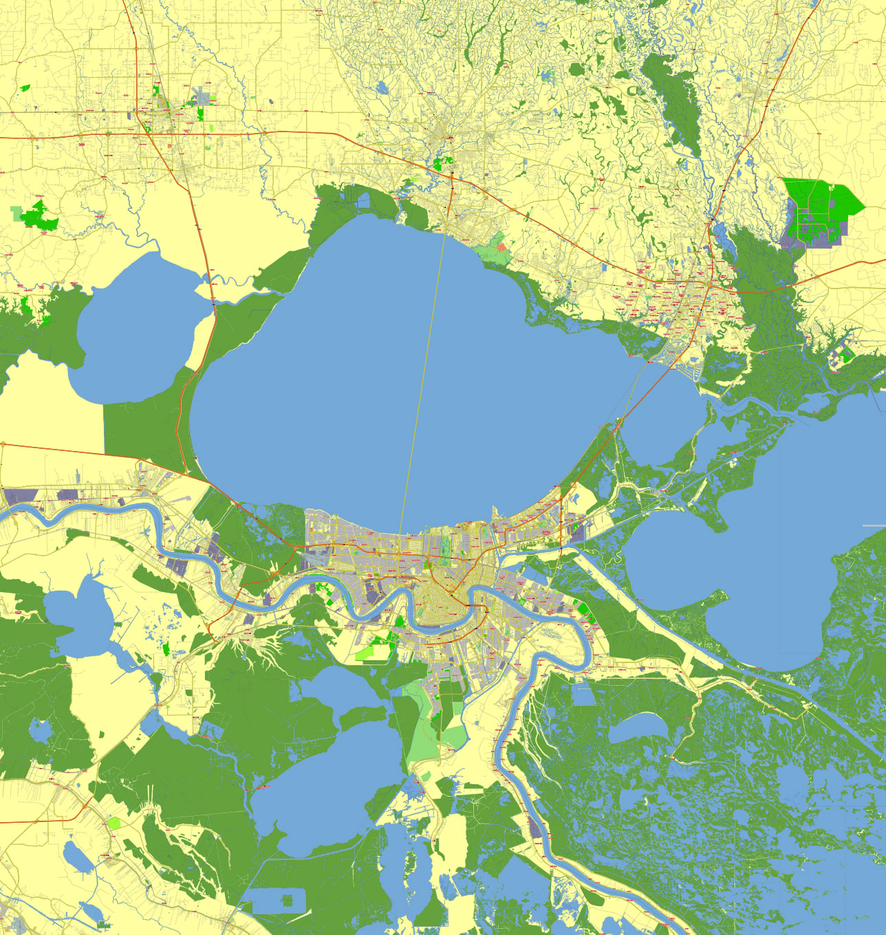
Principal streets and roads, names places, residential streets and roads, road number labels, water objects, land use areas.
New Orleans Louisiana US vector map svg free
DOWNLOAD ARCHIVE FOR FREE >>>
Distributed with Creative Commons Attribution 4.0 International License
SEE ALSO FULL VERSION OF THE New Orleans Louisiana US vector map (Adobe Illustrator, PDF etc.)
New Orleans, Louisiana, is a city rich in history and culture, known for its distinctive architecture, vibrant music scene, and delicious cuisine. Here are some of the principal streets, roads, and city districts that define the city:
Principal Streets and Roads
- Canal Street: One of the main thoroughfares in New Orleans, running from the Mississippi River to Mid-City. It separates the French Quarter from the Central Business District (CBD).
- Bourbon Street: Located in the French Quarter, Bourbon Street is famous for its vibrant nightlife, bars, and historic buildings.
- St. Charles Avenue: Known for its picturesque oak trees and historic mansions, it’s also the route for many Mardi Gras parades and the St. Charles Streetcar Line.
- Magazine Street: A six-mile-long street that runs parallel to the Mississippi River, known for its eclectic shops, restaurants, and cafes.
- Esplanade Avenue: A historic avenue lined with Creole-style cottages and mansions, connecting the French Quarter to City Park.
- Decatur Street: Runs parallel to the Mississippi River in the French Quarter, home to landmarks like Jackson Square and the French Market.
- Claiborne Avenue: A major north-south thoroughfare that cuts through several neighborhoods, including Tremé and Central City.
- Poydras Street: A main artery in the CBD, it is lined with office buildings, hotels, and the Superdome.
Principal City Districts
- French Quarter: The oldest neighborhood in New Orleans, known for its historic buildings, vibrant nightlife, and cultural landmarks.
- Central Business District (CBD): The downtown area, home to skyscrapers, businesses, the Superdome, and Harrah’s Casino.
- Garden District: Famous for its well-preserved antebellum mansions and lush gardens, it’s a beautiful residential area with historic significance.
- Uptown: A large district including neighborhoods like the Garden District, Carrollton, and Audubon, known for Tulane University and Loyola University, as well as Audubon Park and Zoo.
- Mid-City: A diverse neighborhood home to City Park, the New Orleans Museum of Art, and the annual Jazz & Heritage Festival.
- Marigny: Adjacent to the French Quarter, known for its Creole cottages, bohemian vibe, and music clubs along Frenchmen Street.
- Bywater: Known for its colorful homes, artistic community, and hip cafes and bars.
- Tremé: One of the oldest African-American neighborhoods in the United States, known for its cultural and historical significance in jazz music and civil rights.
- Algiers: Located on the west bank of the Mississippi River, it’s a historic district known for its quaint village feel and stunning views of the city skyline.
- Lakeview: A suburban neighborhood near Lake Pontchartrain, known for its family-friendly atmosphere and outdoor recreational opportunities.
These streets and districts capture the essence of New Orleans’ unique charm, each contributing to the city’s rich tapestry of culture, history, and community.
 Author: Kirill Shrayber, Ph.D. FRGS