Editable Vector Map of the Napier New Zealand in SVG format.
Can be edited in the following programs: Adobe Illustrator, CorelDraw, InkScape
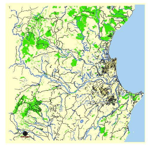
Principal streets and roads, names places, residential streets and roads, road number labels, water objects, land use areas.
Napier New Zealand vector map svg free
DOWNLOAD ARCHIVE FOR FREE >>>
Distributed with Creative Commons Attribution 4.0 International License
SEE ALSO FULL VERSION OF THE Napier New Zealand vector map (Adobe Illustrator, PDF etc.)
Napier, located on the eastern coast of New Zealand’s North Island, is known for its distinctive Art Deco architecture and scenic coastal views. Here are some of the principal streets, roads, and city districts of Napier:
Principal Streets and Roads
- Marine Parade: A scenic road running along the coastline, famous for its views of the ocean and the many tourist attractions like the National Aquarium of New Zealand and the Pania of the Reef statue.
- Emerson Street: A key shopping and pedestrian street in Napier’s central business district (CBD), known for its Art Deco buildings and a variety of shops, cafes, and restaurants.
- Tennyson Street: Another important street in the CBD, featuring several historical buildings and access to the Napier Municipal Theatre.
- Hastings Street: Runs parallel to Marine Parade and is another major thoroughfare with various businesses, eateries, and shops.
- Kennedy Road: A main arterial route that connects different parts of Napier, including residential areas and commercial zones.
- Taradale Road: A major road linking Napier with the suburb of Taradale, featuring many commercial establishments and services.
- Ahuriri Bypass (State Highway 2): Connects the Napier port area with the city center and other regions, facilitating significant traffic flow.
City Districts and Suburbs
- Napier Central (CBD): The heart of the city, known for its Art Deco architecture, shopping areas, and cultural sites.
- Ahuriri: A historic port area that has undergone revitalization, now featuring trendy cafes, bars, restaurants, and boutique shops. It’s a popular area for both locals and tourists.
- Bluff Hill: A residential area offering stunning views of the city and Hawke’s Bay. The Napier Botanical Gardens are also located here.
- Taradale: A significant suburb to the west of Napier, known for its wineries, EIT (Eastern Institute of Technology) campus, and a more suburban lifestyle. It also hosts the Taradale Shopping Centre.
- Marewa: A residential suburb with many Art Deco houses, reflecting Napier’s architectural heritage.
- Onekawa: An industrial and residential area, home to the Onekawa Industrial District and several schools.
- Greenmeadows: A suburb known for its parks, recreational areas, and proximity to wineries.
- Westshore: A coastal suburb offering beach access, popular for its residential appeal and proximity to the airport.
- Tamatea: A residential suburb providing family-friendly living environments with several schools and parks.
These streets and districts encapsulate the unique blend of historical charm and modern amenities that Napier offers, making it a vibrant and attractive city for both residents and visitors.
 Author: Kirill Shrayber, Ph.D. FRGS