Editable Vector Map of the Milwaukee Wisconsin US in SVG format.
Can be edited in the following programs: Adobe Illustrator, CorelDraw, InkScape
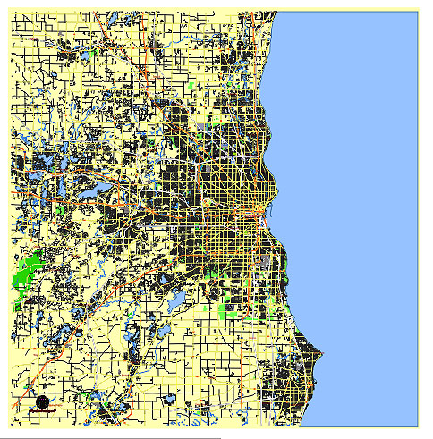
Principal streets and roads, names places, residential streets and roads, road number labels, water objects, land use areas.
Milwaukee Wisconsin US editable vector map svg free
DOWNLOAD ARCHIVE FOR FREE >>>
Distributed with Creative Commons Attribution 4.0 International License
SEE ALSO FULL VERSION OF THE Milwaukee Wisconsin US vector map (Adobe Illustrator, PDF etc.)
Milwaukee, Wisconsin, is a vibrant city with numerous significant streets, roads, and districts that define its urban landscape. Here are some of the principal streets, roads, and city districts in Milwaukee:
Principal Streets and Roads
- Wisconsin Avenue: One of the main east-west thoroughfares in downtown Milwaukee, known for its historic and commercial significance.
- North Avenue: A major east-west street running through several Milwaukee neighborhoods, known for its vibrant commercial and cultural spots.
- Lincoln Memorial Drive: A scenic route along the Lake Michigan shoreline, popular for its parks and beaches.
- Lake Drive: Running parallel to Lincoln Memorial Drive, it offers beautiful views of Lake Michigan and features many historic homes.
- Bluemound Road: A major east-west arterial road running through the western suburbs and into Milwaukee, known for shopping and dining options.
- Capitol Drive: A key east-west route through the north side of Milwaukee, connecting various neighborhoods and commercial areas.
- National Avenue: An important diagonal route running southwest from downtown, passing through the Historic Mitchell Street District.
- Water Street: A central street in downtown Milwaukee known for its nightlife, restaurants, and bars.
- Greenfield Avenue: An important street in the southern part of the city, extending into the suburbs.
Principal City Districts
- Downtown Milwaukee: The central business district, home to major corporations, cultural institutions, and entertainment venues.
- Historic Third Ward: A revitalized area known for its art galleries, boutique shops, and the Milwaukee Public Market.
- East Side: A vibrant, eclectic neighborhood known for its bars, restaurants, and cultural attractions, including the University of Wisconsin-Milwaukee.
- Bay View: A hip, progressive neighborhood known for its trendy restaurants, bars, and parks along Lake Michigan.
- Walker’s Point: An up-and-coming district known for its breweries, distilleries, and trendy eateries.
- Riverwest: A diverse and artsy neighborhood known for its community events and local businesses.
- Menomonee Valley: An area that has undergone significant redevelopment, featuring attractions like the Harley-Davidson Museum and Three Bridges Park.
- Harbor District: A revitalized waterfront area focused on sustainable development and mixed-use projects.
- Bronzeville: A historic African American neighborhood with cultural and historical significance, undergoing revitalization efforts.
These streets and districts are integral to Milwaukee’s identity, each contributing to the city’s cultural, economic, and social fabric.
 Author: Kirill Shrayber, Ph.D. FRGS