Editable Vector Map of the Indianapolis Indiana US in SVG format.
Can be edited in the following programs: Adobe Illustrator, CorelDraw, InkScape
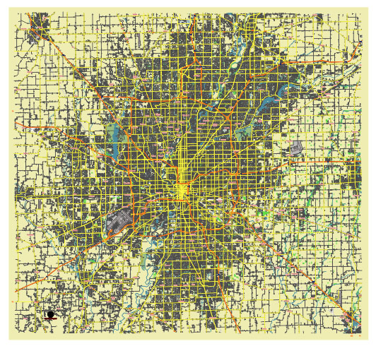
Principal streets and roads, names places, residential streets and roads, road number labels, water objects, land use areas.
Indianapolis Indiana US editable vector map svg free
DOWNLOAD ARCHIVE FOR FREE >>>
Distributed with Creative Commons Attribution 4.0 International License
SEE ALSO FULL VERSION OF THE Indianapolis Indiana US vector map (Adobe Illustrator, PDF etc.)
Indianapolis, the capital city of Indiana, is laid out in a grid pattern with a downtown area surrounded by various neighborhoods and districts. Some principal streets, roads, and districts of Indianapolis include:
- Downtown Indianapolis: The heart of the city, where you’ll find many of the major attractions, businesses, and government buildings. Key streets include:
- Meridian Street: Runs north-south through downtown and is a major artery in the city.
- Market Street: Another important east-west thoroughfare, intersecting with Meridian Street.
- Monument Circle: A circular, brick-paved area in the heart of downtown, featuring the iconic Soldiers and Sailors Monument.
- Massachusetts Avenue (Mass Ave): Known for its trendy shops, restaurants, and theaters. It’s a popular spot for nightlife and cultural events.
- Broad Ripple: A vibrant neighborhood known for its nightlife, art galleries, and unique shops. Key streets include:
- Broad Ripple Avenue: The main thoroughfare through the neighborhood, lined with bars, restaurants, and shops.
- Fountain Square: An eclectic district southeast of downtown, known for its arts scene, vintage shops, and trendy eateries.
- Virginia Avenue: Runs through several neighborhoods including Fletcher Place and Fountain Square, and is known for its restaurants and shops.
- Indiana Avenue: Historically significant as the center of the city’s African American community, with a rich jazz history.
- Cultural Trail: A bike and pedestrian-friendly path connecting many of the city’s cultural districts and landmarks.
- Interstate 65 and Interstate 70: Major highways intersecting in downtown Indianapolis, facilitating transportation throughout the city and beyond.
- White River State Park: Located just west of downtown, offering green spaces, walking trails, and attractions like the Indianapolis Zoo and the Eiteljorg Museum of American Indians and Western Art.
- The Canal Walk: A scenic waterway downtown, popular for walking, jogging, and enjoying recreational activities.
These are just some of the principal streets, roads, and districts that make up the vibrant tapestry of Indianapolis, each with its own unique character and attractions.
 Author: Kirill Shrayber, Ph.D. FRGS