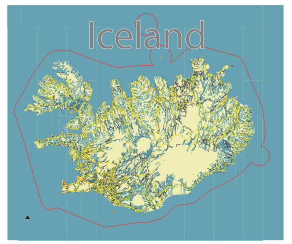
Editable Vector Map of the Iceland full in SVG format.
Can be edited in the following programs: Adobe Illustrator, CorelDraw, InkScape
Principal streets and roads, names places, residential streets and roads, road number labels, water objects, land use areas.

Iceland full editable vector map svg free
DOWNLOAD ARCHIVE FOR FREE >>>
Distributed with Creative Commons Attribution 4.0 International License
SEE ALSO FULL VERSION OF THE Iceland full vector map (Adobe Illustrator, PDF etc.)
Iceland is known for its stunning natural landscapes and relatively sparse population. Here are the principal cities, towns, and roads of Iceland:
Principal Cities and Towns
- Reykjavík: The capital and largest city of Iceland, located in the southwest part of the country. It is the cultural and economic hub, with attractions like the Hallgrímskirkja church, Harpa concert hall, and the National Museum of Iceland.
- Kópavogur: A large suburb of Reykjavík, known for its modern architecture, shopping centers, and cultural venues.
- Hafnarfjörður: Another suburb of Reykjavík, famous for its lava fields, Viking festivals, and vibrant art scene.
- Akureyri: Often referred to as the “Capital of the North,” this town is located in northern Iceland and is known for its beautiful fjord setting, botanical garden, and proximity to ski areas.
- Reykjanesbær: Located near the Keflavík International Airport, this town is the gateway for many visitors to Iceland and has attractions like the Viking World museum.
- Selfoss: A town in the south of Iceland, serving as a commercial hub for the surrounding agricultural area.
- Ísafjörður: The largest town in the Westfjords region, known for its scenic beauty and outdoor activities like hiking and skiing.
- Egilsstaðir: The largest town in East Iceland, acting as a service center for the region and a gateway to natural attractions like the Hallormsstaður forest and Hengifoss waterfall.
- Vestmannaeyjar (Westman Islands): An archipelago off the south coast, with the main town of Heimaey being known for its puffin colonies and the Eldfell volcanic crater.
- Húsavík: A town on the northern coast, renowned for its whale watching tours and the Húsavík Whale Museum.
Principal Roads
- Ring Road (Route 1): The most important road in Iceland, it encircles the entire island, connecting all the major towns and regions. It’s the main route for most tourists exploring the country.
- Golden Circle Route: A popular tourist route that includes Þingvellir National Park, the Geysir geothermal area, and Gullfoss waterfall.
- Route 41 (Reykjanesbraut): Connects Reykjavík to Keflavík International Airport, passing through the town of Reykjanesbær.
- Route 36: Part of the Golden Circle, connecting Reykjavík with Þingvellir National Park.
- Route 47 (Hvalfjörður): Runs along the scenic Hvalfjörður fjord, providing an alternative to the Hvalfjörður Tunnel.
- Route 35: Connects Selfoss with the Golden Circle attractions and extends into the highlands as Kjölur Route, an unpaved road leading through the interior of the island.
- Route 85: Runs along the northern coast, connecting Húsavík with other northern towns and providing access to the Tjörnes Peninsula.
- Route 76: Connects the northern towns of Siglufjörður and Ólafsfjörður, passing through beautiful coastal scenery.
- Route 92: Connects Egilsstaðir with the coastal town of Reyðarfjörður in East Iceland.
- Route 54: Runs through the Snæfellsnes Peninsula, offering access to scenic locations like Snæfellsjökull National Park.
These roads and towns are crucial for both residents and visitors, allowing easy access to the diverse landscapes and cultural sites across Iceland.

 Author: Kirill Shrayber, Ph.D. FRGS