Editable Vector Map of the Essen Germany in SVG format.
Can be edited in the following programs: Adobe Illustrator, CorelDraw, InkScape
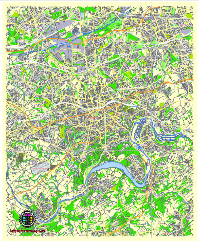
Principal streets and roads, names places, residential streets and roads, road number labels, water objects, land use areas.
Essen Germany editable vector map svg free
DOWNLOAD ARCHIVE FOR FREE >>>
Distributed with Creative Commons Attribution 4.0 International License
SEE ALSO FULL VERSION OF THE Essen Germany vector map (Adobe Illustrator, PDF etc.)
Essen, Germany, is a major city in the North Rhine-Westphalia region. Here are some principal streets, roads, and city districts in Essen:
Streets and Roads:
- B224 (Essener Straße): A major road connecting Essen with other nearby cities like Bochum and Gelsenkirchen.
- B227 (Ruhrallee): Another important road running through Essen, connecting different parts of the city.
- B224 (Huttropstraße): A significant street in the Huttrop district, connecting it with other parts of Essen.
- Bismarckstraße: A prominent street in the city center, known for its shops and restaurants.
- Alfredstraße: A popular street with cafes, bars, and shops, particularly known for its nightlife.
City Districts:
- City Center (Innenstadt): The heart of Essen, featuring landmarks like the Essen Cathedral (Essener Dom) and the Rathaus Essen (Essen City Hall).
- Rüttenscheid: A vibrant district with a mix of residential areas, shopping streets, and cultural attractions like the Folkwang Museum.
- Steele: A historic district with charming architecture and a lively market square.
- Kettwig: Situated on the Ruhr River, known for its picturesque old town and waterfront promenade.
- Frohnhausen: A diverse district with a mix of residential and commercial areas, home to the Grugapark, a large park and botanical garden.
These are just a few examples, as Essen is a large city with many streets, roads, and districts, each with its own character and attractions.
 Author: Kirill Shrayber, Ph.D. FRGS