Editable Vector Map of the Darmstadt Germany in SVG format.
Can be edited in the following programs: Adobe Illustrator, CorelDraw, InkScape
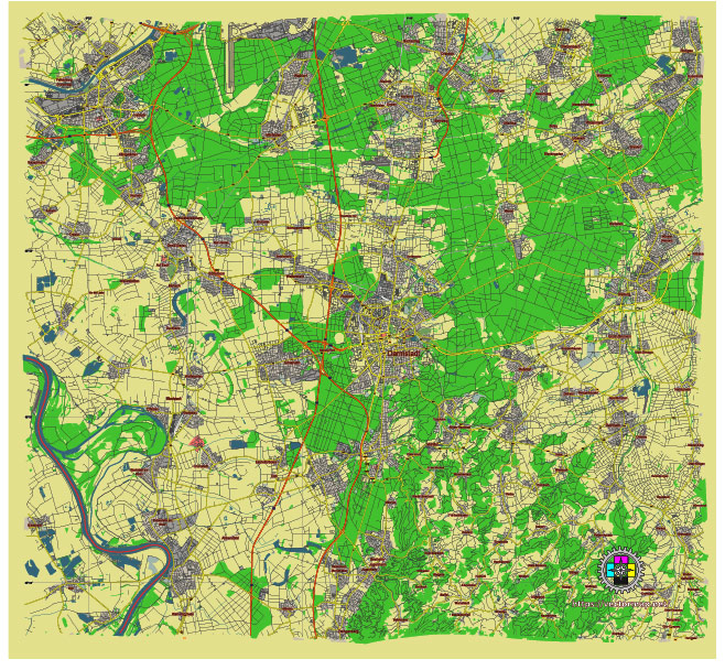
Principal streets and roads, names places, residential streets and roads, road number labels, water objects, land use areas.
Darmstadt Germany editable vector map svg free
DOWNLOAD ARCHIVE FOR FREE >>>
Distributed with Creative Commons Attribution 4.0 International License
SEE ALSO FULL VERSION OF THE Darmstadt Germany vector map (Adobe Illustrator, PDF etc.)
Darmstadt is a city in the state of Hesse in Germany, known for its significant contributions to science, education, and the arts. Below are some of the principal streets, roads, and city districts of Darmstadt:
Principal Streets and Roads:
- Luisenplatz: The central square of Darmstadt, surrounded by important buildings and serving as a hub for public transport.
- Rheinstraße: A major thoroughfare leading from Luisenplatz westward towards the Autobahn (A5).
- Bismarckstraße: Runs from the main train station towards the east and is a key street for traffic and commerce.
- Heinrichstraße: Connects the northern parts of the city with the city center.
- Mathildenhöhe: An area known for its Art Nouveau buildings, with the street being a significant cultural and historical route.
- Pützerstraße: Located in the eastern part of the city, notable for residential areas and proximity to the university.
Principal City Districts:
- Innenstadt (City Center): The heart of Darmstadt with shopping streets, Luisenplatz, and many cultural institutions.
- Bessungen: A historic district known for its picturesque streets and the Orangery park.
- Arheilgen: A northern district that is primarily residential but also has industrial areas.
- Eberstadt: Located in the south, Eberstadt is a mix of residential zones and historical sites.
- Kranichstein: Known for its housing estates and the Kranichstein Hunting Lodge, now a museum.
- Wixhausen: The northernmost district, characterized by a village-like atmosphere and several green spaces.
- Woogsviertel: Centered around the Großer Woog lake, popular for recreation and outdoor activities.
Cultural and Recreational Areas:
- Mathildenhöhe: As mentioned, this area is significant for its Art Nouveau architecture and the Artists’ Colony.
- Herrngarten: The largest park in the city, located near the city center.
- Rosenhöhe: Another large park, known for its rose gardens and historic buildings.
Darmstadt combines historical significance with modern living, making it a dynamic and attractive place for residents and visitors alike.
 Author: Kirill Shrayber, Ph.D. FRGS