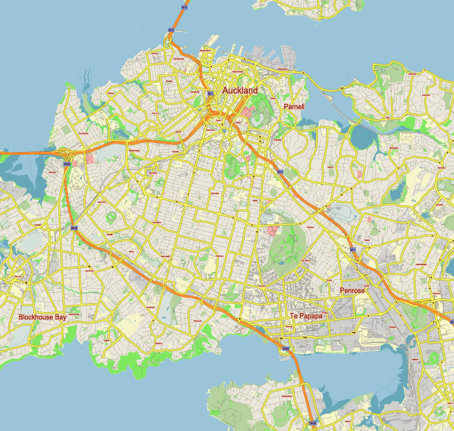
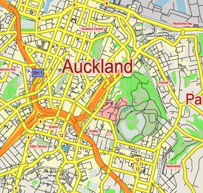
Editable Vector Map of the Auckland New Zealand in SVG format.
Can be edited in the following programs: Adobe Illustrator, CorelDraw, InkScape
Principal streets and roads, names places, residential streets and roads, road number labels, water objects, land use areas.
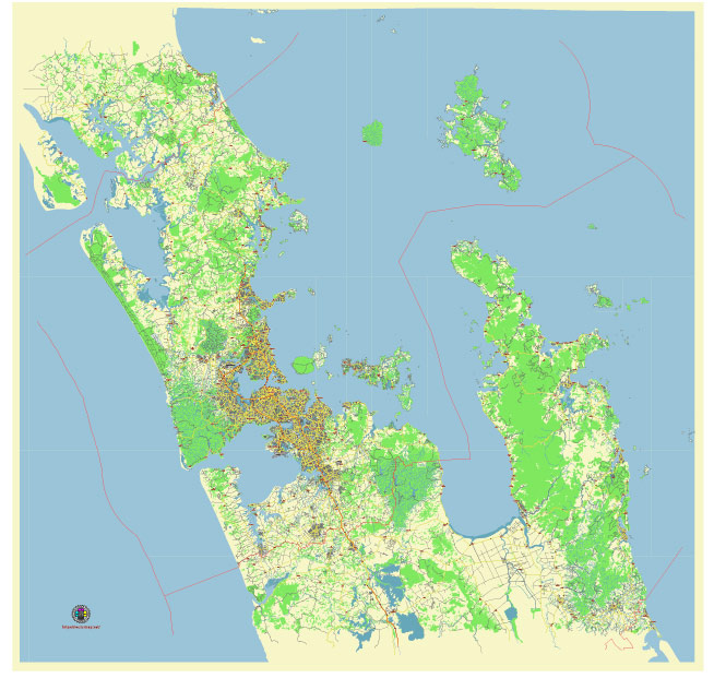
Auckland New Zealand editable vector map svg free
DOWNLOAD ARCHIVE FOR FREE >>>
Distributed with Creative Commons Attribution 4.0 International License
SEE ALSO FULL VERSION OF THE Auckland New Zealand vector map (Adobe Illustrator, PDF etc.)
Auckland, New Zealand’s largest city, is known for its vibrant city life, stunning harbor, and diverse neighborhoods. Here are some of the principal streets, roads, and city districts in Auckland:
Auckland New Zealand editable vector map svg free
Principal Streets and Roads
- Queen Street: The main commercial thoroughfare in Auckland’s CBD (Central Business District), lined with shops, restaurants, and businesses.
- Karangahape Road (K Road): Known for its bohemian vibe, this street is famous for nightlife, cafes, and vintage shops.
- Ponsonby Road: A trendy street in the Ponsonby district, known for its cafes, restaurants, and boutiques.
- Symonds Street: A major road in the CBD, intersecting with several other key roads and home to many university buildings.
- Tamaki Drive: A scenic coastal road that runs along the waterfront, offering stunning views of the Hauraki Gulf and connecting to several beaches.
- Dominion Road: Famous for its ethnic eateries, especially Asian cuisine, and a major route through several suburbs.
- Great North Road: Runs through several suburbs and is a key arterial road in Auckland.
- New North Road: A significant road connecting the city to the western suburbs.
Auckland New Zealand editable vector map svg free
City Districts
- Central Business District (CBD): The heart of Auckland, where major businesses, shops, and entertainment venues are located.
- Ponsonby: Known for its vibrant nightlife, cafes, and heritage buildings.
- Parnell: One of Auckland’s oldest suburbs, with boutique shops, art galleries, and the beautiful Parnell Rose Gardens.
- Newmarket: A major shopping and entertainment district, with a large concentration of retail stores and eateries.
- Mt Eden: Famous for its volcanic cone, Mt Eden, this suburb offers a mix of historic charm and modern amenities.
- Grey Lynn: A residential area known for its community vibe, parks, and annual Grey Lynn Festival.
- Parnell: Another historic suburb, known for its dining, shopping, and Parnell Village.
- Mission Bay: A beachside suburb with a relaxed atmosphere, popular for its promenade and dining options.
- Takapuna: Located on the North Shore, it boasts a popular beach, shopping, and dining precinct.
- Devonport: A picturesque suburb with Victorian architecture, naval history, and stunning views of the city skyline.
Major Highways and Motorways
- State Highway 1 (SH1): The main north-south route through Auckland, connecting the city to both the northern and southern parts of New Zealand.
- State Highway 16 (SH16): Also known as the Northwestern Motorway, connecting the city to the western suburbs and beyond.
- State Highway 20 (SH20): The Southwestern Motorway, providing a link between the southern suburbs and the airport.
- State Highway 18 (SH18): Known as the Upper Harbour Motorway, connecting the North Shore with the western suburbs.
These streets, roads, and districts are integral to Auckland’s character, each contributing to the city’s diverse and dynamic atmosphere.
 Author: Kirill Shrayber, Ph.D. FRGS