Editable Vector Map of the Aarhus Denmark in SVG format.
Can be edited in the following programs: Adobe Illustrator, CorelDraw, Inkscape
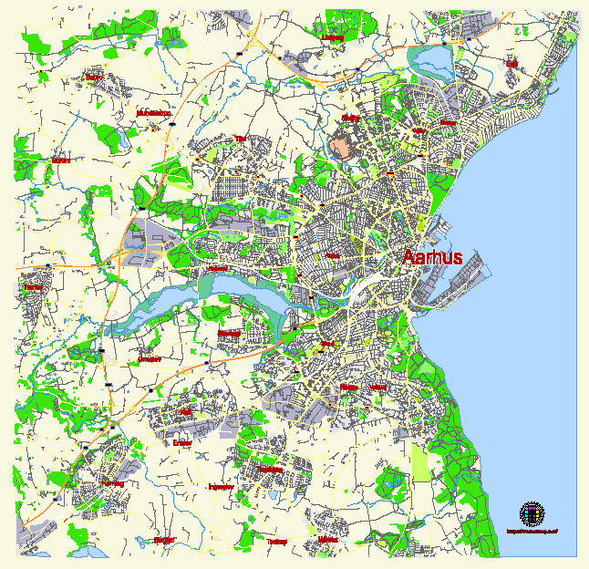
Principal streets and roads, names places, residential streets and roads, road number labels, water objects, landuse areas.
Aarhus Denmark editable vector map svg free
DOWNLOAD ARCHIVE FOR FREE >>>
Distributed with Creative Commons Attribution 4.0 International License
SEE ALSO FULL VERSION OF THE Aarhus Denmark vector map (Adobe Illustrator, PDF etc.)
Aarhus, the second-largest city in Denmark, is known for its rich history, vibrant culture, and significant educational institutions. Here are some of the principal streets, roads, and city districts of Aarhus:
Principal Streets and Roads
- Strøget:
- A famous pedestrian street in the city center, lined with shops, cafes, and restaurants. It is a central hub for shopping and social activities.
- Nørregade:
- A major thoroughfare that runs through the northern part of the city center, connecting various key locations.
- Banegårdspladsen:
- The square in front of Aarhus Central Station, serving as a major transit hub with access to buses, trains, and taxis.
- Vestergade:
- Another central street known for its vibrant nightlife, shops, and historical buildings.
- Søndergade:
- A pedestrian street that is part of the main shopping district, featuring a variety of stores and eateries.
- Viborgvej:
- A significant road that connects the city with Viborg, running through residential and commercial areas.
- Ringgaden (The Ring Road):
- An important ring road encircling the city center, providing access to various districts and major highways.
Principal City Districts
- Aarhus C (City Center):
- The heart of Aarhus, encompassing the central business district, main shopping areas, historical sites, and key cultural institutions like the Aarhus Theatre and ARoS Aarhus Art Museum.
- Frederiksbjerg:
- A vibrant and densely populated district south of the city center, known for its bustling markets, cozy cafes, and restaurants.
- Trøjborg:
- Located north of the city center, this district is popular among students and young professionals, with a lively atmosphere, cinemas, and parks.
- Øgadekvarteret (The East End):
- Characterized by its charming old buildings, this district is close to the university and features a mix of residential and commercial areas.
- Vesterbro:
- An upscale district west of the city center, known for its beautiful villas, green spaces, and proximity to the Botanical Garden.
- Aarhus V (Aarhus West):
- A diverse district with a mix of residential neighborhoods, industrial areas, and shopping centers like City Vest.
- Aarhus N (Aarhus North):
- Home to Aarhus University and various research institutions, this district is a hub for education and innovation.
- Aarhus S (Aarhus South):
- Primarily residential, this district includes suburbs and newer housing developments, offering a quieter living environment.
- Aarhus Ø (Aarhus East):
- A newly developed waterfront district featuring modern architecture, residential complexes, and recreational areas along the harbor.
- Hasle:
- A suburban district west of the city center, known for its family-friendly environment and proximity to nature.
These streets, roads, and districts together form the vibrant and dynamic fabric of Aarhus, making it a unique and engaging city to explore and live in.
 Author: Kirill Shrayber, Ph.D. FRGS