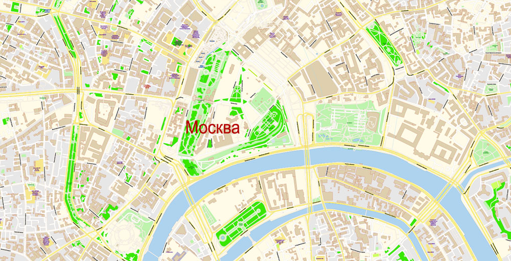
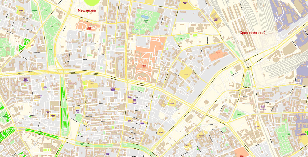
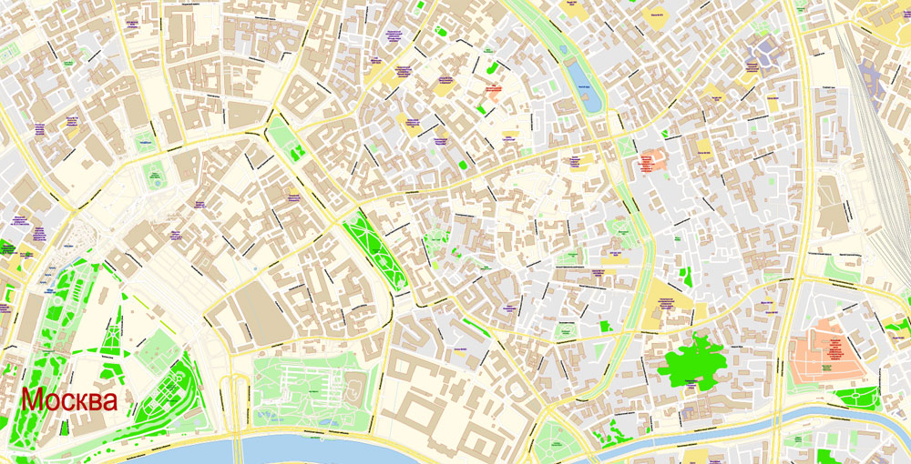
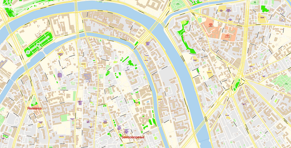
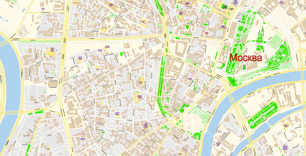
Urban plan Moscow: Digital Vector Maps for Printing

Related Images "Urban plan Moscow":


Urban plan Moscow: City Vector Maps for Business, Tourism, Education
Moscow is the capital of the Russian Federation, as well as a major industrial, educational, cultural, commercial, scientific, and transport center of Russia.
Most historians believe that the city got its name from the river on which it was built. But there is another opinion that the river was named after the city, and the name was formed by adding the root "mosk" - flint and "cov" - to hide.
The first mention of the city is found in 1147 in the Ipatiev Chronicle, so this year is considered the year of the foundation of Moscow since the exact date of foundation remains unknown.
The very first settlement on the site of modern Moscow was surrounded by a moat and wooden walls. The first stone walls around the city appeared only in 1367, and the modern Kremlin walls were erected in the period from 1485 to 1495.
Throughout the history of the city, it has survived many sieges and has been burned several times during wars.
In 1811, on the eve of the Patriotic War, the population of Moscow was 275 thousand people, and now the number of inhabitants has exceeded 10 million people.
Geography
Moscow is located between the Volga and the Oka, at the junction of the Meshcherskaya lowland, the Moskvoretsko-Oka plain, and the Smolensk-Moscow Upland. Currently, Moscow is the smallest subject of the Russian Federation by area.
Moscow is located on both sides of the river of the same name. In addition to Moscow, other rivers flow through the city. There are about 400 ponds in the city, as well as several lakes and other reservoirs.

The average height of the city above sea level is 156 meters. The highest natural point of Moscow is the Teplostanskaya hill with a height of 255 meters. The total length of the city within the Moscow Ring Road is: from west to east – 40 kilometers, from north to south - 38 kilometers.
The offset relative to UTC (Coordinated Universal Time) is +4 hours.
Despite the very high degree of development, green areas occupy about a third of the total area of Moscow. The most famous forest and park areas are Butovsky Forest Park, Lublin Forest Park, Zamoskvoretsky Forest Park, Filevsky Park, Timiryazevsky Park, Izmailovsky Park, and others. In addition, the city is home to a part of Moose Island - a natural national park, as well as various recreational areas and squares.
Climate
Moscow is characterized by a temperate continental climate with fairly mild winters and humid warm summers. Despite this, Moscow is among the capitals with the most severe climate. Excessive heat and sharp frosts practically do not happen in Moscow, however, in recent years there has been a deviation from the norm more often. During the year, 550-650 mm of precipitation mainly falls.
Usually, frosts in Moscow begin at the end of September and end in mid-May. Winter with persistent frosts begins on the 20th of November and ends on March 10. Snow cover is usually established together with persistent frosts and completely disappears by the 10th of April. By the end of winter, the height of the snow cover in Moscow is about 35 centimeters.
The coldest month of the year is January – the temperature this month drops to -10 °C. The lowest recorded temperature was -45°C. In the other two months, short thaws are often observed.
The hottest month of the year is July when the thermometer rises to +20 °C. The absolute record was set in the summer of 2010 when the temperature reached +38 °C. The weather in early summer is very unstable, with frequent thunderstorms and sudden temperature changes.
Transport
Since ancient times, Moscow has been one of the largest transport hubs in Russia. The city is still located in the very center of a web of highways and railways. Various types of public transport are also developed inside the city, and since 1935 the metro has been operating in Moscow.
There are 9 train stations and 4 airports in Moscow.
The main means of transportation within Moscow remains the metro. On average, the Moscow metro transports 6.5 million people a day. After the Tokyo subway, it is the second most intensive subway system in the world. River transport is also actively used in the capital.

Culture
Moscow is an important cultural and historical center of Europe. Our capital is famous all over the world for its museums, architectural and historical monuments, as well as entertainment infrastructure.
In total, there are more than a hundred different theaters in modern Moscow, and many of them are known all over the world. There are also several dozen museums and zoological gardens.
Many large Russian film studios, for example, Soyuzmultfilm, Mosfilm, and others are located in Moscow. The Moscow International Film Festival is also held here every year.
Many sights of Moscow are included in the UNESCO World Heritage List. Some buildings and monuments were built several hundred years ago.
Related Images "Urban plan Moscow":
Urban planning Moscow Russia: Fully Editable City Maps


Moscow Russia Metro Area Printable Vector Maps in AutoCAD DWG DXF, Adobe Illustrator, PDF


Moscow Urban Plan: Digital Cartography for Business and Education


City Plan of Moscow Russia: Digital Vector City Map

- Urban plan Cyprus Island CDR
- Urban plan Jakarta Indonesia 16 ai
- Urban plan Istanbul Turkey
- Urban plan State Florida
- Urban plan Adelaide Metro DWG
- Urban plan Cincinnati Ohio CDR
- Urban plan US Relef Rivers
- Urban plan Cape Canaveral Florida PDF
- Urban plan Asuncion Paraguay
- Urban plan Madison Wisconsin
- Urban plan Washington DC ai
- Urban plan Buenos Aires Argentina
- Urban plan Vienna Wien Austria
- Urban plan Oakland Berkeley Richmond Alameda San Leandro Albany CDR
- Urban plan Perth Australia
- Urban plan Czech Republic Admin
- Urban plan Madrid Spain PDF
- Urban plan Finland Admin
- Urban plan Venezia Venice
- Urban plan Mykonos Island PDF
- Urban plan Evansville 75 Indiana PDF
- Urban plan full Poland 2
- Urban plan Honolulu Oahu Hawaii pdf
- Urban plan Lima Peru AI
- Urban plan Reno Nevada
- Urban plan Austin Texas pdf
- Urban plan Singapore PDF
- Urban plan World Relief Political
- Urban plan Marseille France
- Urban plan Chicago Illinois ai
- Urban plan Canada Admin Districts
- Urban plan San Jose California
- Urban plan Jerusalem Israel Hebrew
- Urban plan Germany Admin PDF
- Urban plan Syria
- Urban plan Beijing China PDF 13
- Urban plan Nantucket Marthas Vineyard
- Urban plan Shenzhen China 17 AI ENG
- Urban plan Severna Park Annapolis Maryland
- Urban plan Yokohama Japan 13 pdf
- Urban plan Des Moines Jowa 3 10
- Urban plan Stuttgart Germany
- Urban plan Kansas City Metro Missouri PDF
- Urban plan San Juan Puerto Rico
- Urban plan Manchester New Hampshire
- Urban plan Stanford University PDF
- Urban plan San Francisco Oakland California
- Urban plan Orlando Florida
- Urban plan Bremen Germany 4 pdf
- Urban plan Anchorage Alaska PDF
- Urban plan New Orleans Louisiana
- Urban plan Salisbury UK PDF
- Urban plan Austria Admin
- Urban plan Perth Australia 13 PDF
- Urban plan Toulon France pdf
- Urban plan La Porte Baytown Texas ai 17
- Urban plan Utrecht Netherlands 25
- Urban plan Trenton New Jersey CDR
- Urban plan Denver Metro
- Urban plan Edmonton PDF
- Urban plan Republica Dominicana y Haiti
- Urban plan Belgium Administrative PDF
- Urban plan Czech Republic Roads
- Urban plan Montgomery Alabama
- Urban plan Australia ZIP PDF
- Urban plan Bristol UK ai
- Urban plan Bend Oregon CDR
- Urban plan Augusta Maine PDF
- Urban plan Abu Dhabi United Arab Emirates
- Urban plan Hong Kong China 17 AI ENG
- Urban plan Brisbane Australia 13 PDF
- Urban plan Camden New Jersey
- Urban plan Cartagena Colombia
- Urban plan Bremen Germany PDF
- Urban plan Salt Lake City Metro