Urban plan Cartagena Colombia: Digital Cartography
Gallery of Images "Urban plan Cartagena Colombia" (635 pics):

Urban plan Cartagena Colombia
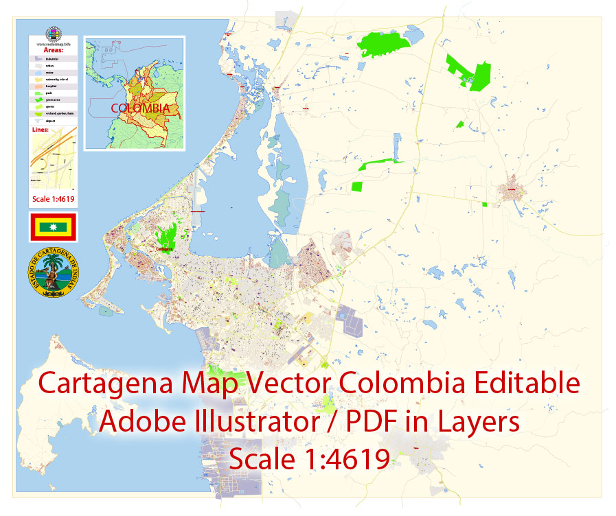
Cartagena (Cartagena de Indias) is the fifth-largest city in Colombia, the administrative center of the Bolivar Department, and a major port on the Caribbean coast. A well-fortified citadel of the XVII century is located on the island of Getsemani and the mainland cape, but the modern city includes other islands, as well as part of the mainland.
Cartagena de Indias was founded in 1533, and was one of the first Spanish settlements in the New World and the main port through which the wealth of the continent was exported to the metropolis. The city was a tasty morsel for British corsairs, who repeatedly tried to capture it in the XVI century. The most famous raid on Cartagena was led by the famous Francis Drake, who in 1586 captured the city, burned the cathedral and held hostages for more than a hundred days, demanding in return a colossal ransom for those times. The Spaniards did their best to secure such an important commercial port for them by building a complex system of fortifications around the outer contours of the city, which are now the main attraction of the city, the total length of the fortifications of Cartagena is more than 11 km.
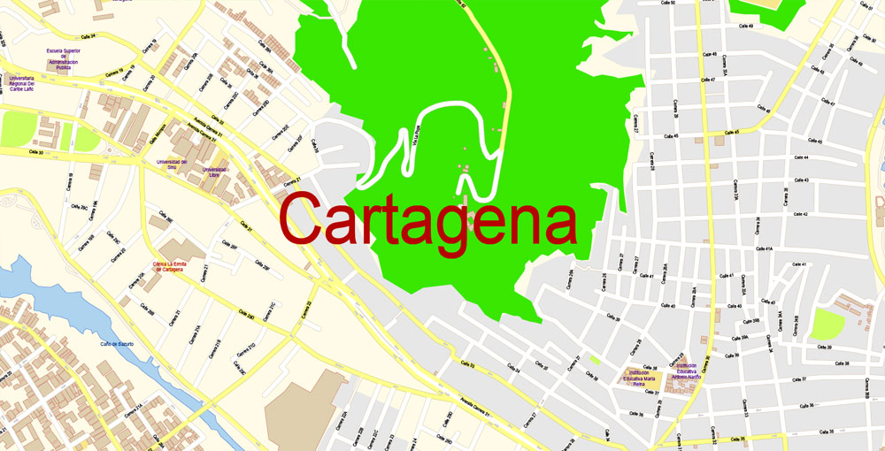
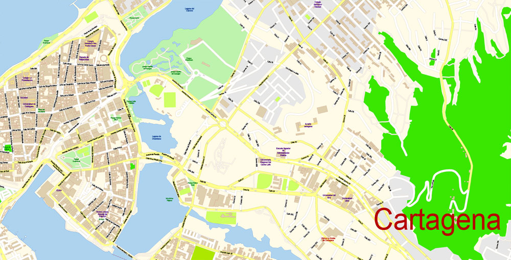
The old town of Cartagena (Ciudad Amurallado), located in its northern part, is the most interesting. It is here that ancient forts and numerous colonial buildings are located. Ciudad Amurallado is divided into four zones: San Diego, La Matuna, Santo Domingo and Getsemani. In the Getsemani area there is the main fortress of Cartagena - Castillo de San Felipe de Barajas, the thickness of the walls of which reaches 12 m. Its construction was carried out in the period from 1533 to 1657. Here, in the Old Town, there is a vast Central Park and the oldest church of the city - Iglesia de Santo Domingo (1536).
Residential areas stretch in the southern part of Cartagena. The center of this area is the square of San Pedro Claver, on which stands the Cathedral (1575-1602). Nearby is Bolivar Square with a monument to the first President of Colombia, an Archaeological Museum and the Palace of the Inquisition (1770). In Cartagena, it is also worth visiting the former Las Beauvedas prison of the 16th century, where an extensive shopping area is now located, the convent of the Convent de La Popa of the 16th century (now a Historical Museum), the Old Port and the promenade with chic villas and restaurants.
In 1980, the historical monuments of Cartagena (the fortress, the main square with the cathedral, St. Peter's Church, the Inquisition Palace, the university building) were declared a UNESCO World Heritage Site.
South of the Getsemani area on the peninsula is the recreation area of Bocagrande and El Lagunito. Here, sandy beaches stretch along the coast, along which there are hotels, restaurants, bars and discos. The Playa Blanca coast is one of the best beach areas in Colombia.
Those who want to relax on quiet picturesque beaches away from the hustle and bustle of the city should go to the islands of Rosario and San Bernardo, located 40 km south of Cartagena, or to the island of Baru. Rosario and San Bernardo Islands National Park is the only underwater park in the country. It covers an area of 19500 hectares. Its main attraction is the underwater world, which attracts diving and snorkeling enthusiasts from all over the world. The islands of del Rosario and Baru offer many diving spots that cannot be missed. Of particular note are Bancos de Salmedina, Bajo Burbujas, and "Montagna submarine" (deer-horned corals, sea feathers and black corals predominate here); El Faro, Octubre Rojo, Pendales, Tesoro Island, El Aparecido and La Coca - in these places "sea whips" corals are often found, and the bottom is mainly covered with turbinarias. The main infrastructure facilities of the National Park are located on the island of Isla Grande. Diving can also be done in the vicinity of the nearby island of Baru, which is surrounded by coral gardens.
Another 40 km south of the islands of Rosario and San Bernardo, the Morrosquillo Bay with the archipelago of the same name stretches along the coast. Its islands of Keitsen, Tintipan, and Mukura are surrounded by some of the most beautiful coral reefs, catsharks, dolphins, turtles and a variety of tropical fish live in the local waters.
Gallery of Images "Urban plan Cartagena Colombia":
Travel Maps for Cartagena, Colombia

Cartagena, Colombia Digital Maps for Tourism, Business, Education


- Urban plan World Political PDF
- Urban plan Perth Australia AI v309
- Urban plan Menlo Park California 13
- Urban plan Osaka Japan
- Urban plan Ulianovsk pdf
- Urban plan Linz Austria
- Urban plan Memphis Tennessee PDF
- Urban plan Wind Point Wisconsin
- Urban plan Murmansk PDF Russia
- Urban plan Thailand Admin Roads
- Urban plan Lima Peru AI
- Urban plan Duke University Durham North Carolina PDF
- Urban plan full Poland Relief
- Urban plan Bismarck North Dakota
- Urban plan Adelaide Australia 13
- Urban plan Denver Colorado CDR
- Urban plan Leeds UK
- Urban plan Tomsk
- Urban plan Karlsruhe Germany ai
- Urban plan Krasnodar PDF
- Urban plan Wind Point Wisconsin AI
- Urban plan Denmark Admin
- Urban plan Hillsboro Oregon
- Urban plan Menlo Park California 17 PDF
- Urban plan La Porte Baytown Texas pdf
- Urban plan Lyon
- Urban plan Charleroi Belgium ai
- Urban plan Venice Venezia Italy pdf
- Urban plan Delray
- Urban plan Essen Germany pdf
- Urban plan Ankara Turkey pdf
- Urban plan Dominica Full PDF
- Urban plan Beirut Lebanon ai
- Urban plan Concord New Hampshire
- Urban plan Boston Massachusetts low PDF
- Urban plan Oulu Finland
- Urban plan Antwerpen Belgium PDF
- Urban plan Denver Colorado PDF
- Urban plan Milano Italy
- Urban plan Salt Lake City Metro
- Urban plan Seattle Washington
- Urban plan Moscow PDF
- Urban plan New York City PDF
- Urban plan Santo Domingo Doninicana
- Urban plan Luxembourg City PDF
- Urban plan Romania Topo Road
- Urban plan Beijing China PDF 13
- Urban plan Rochester New York PDF
- Urban plan Syracuse New York
- Urban plan Kemi Tornio Finland
- Urban plan Evansville 75 Indiana
- Urban plan Harrisburg Pennsylvania
- Urban plan Allentown Pennsylvania PDF
- Urban plan Wisconsin State
- Urban plan San Juan Puerto Rico
- Urban plan Tucson Arizona PDF
- Urban plan Athens Pireas Greece ENG
- Urban plan Baltimore Counties
- Urban plan La Porte Baytown Texas ai 15