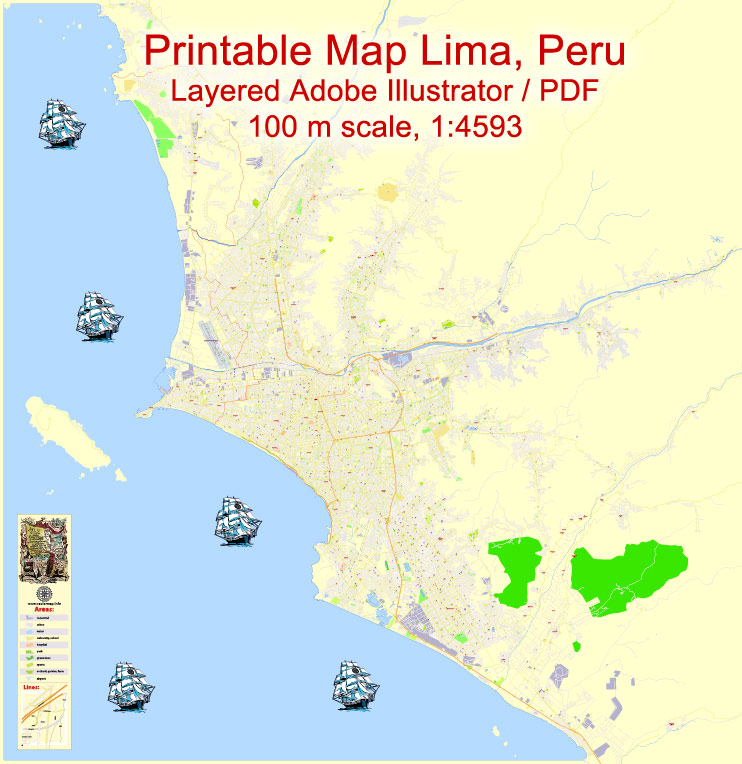
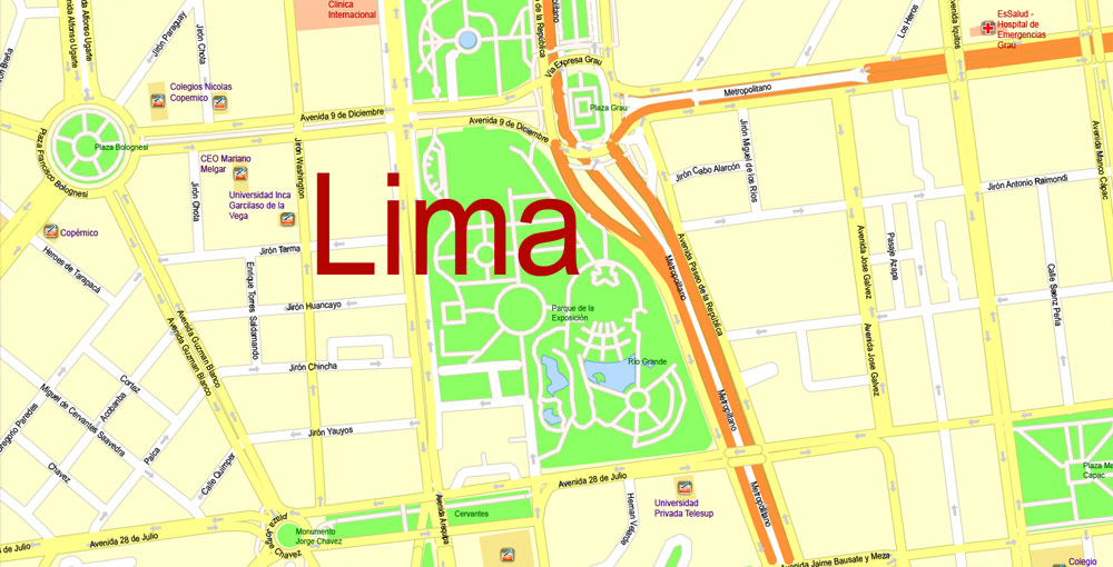
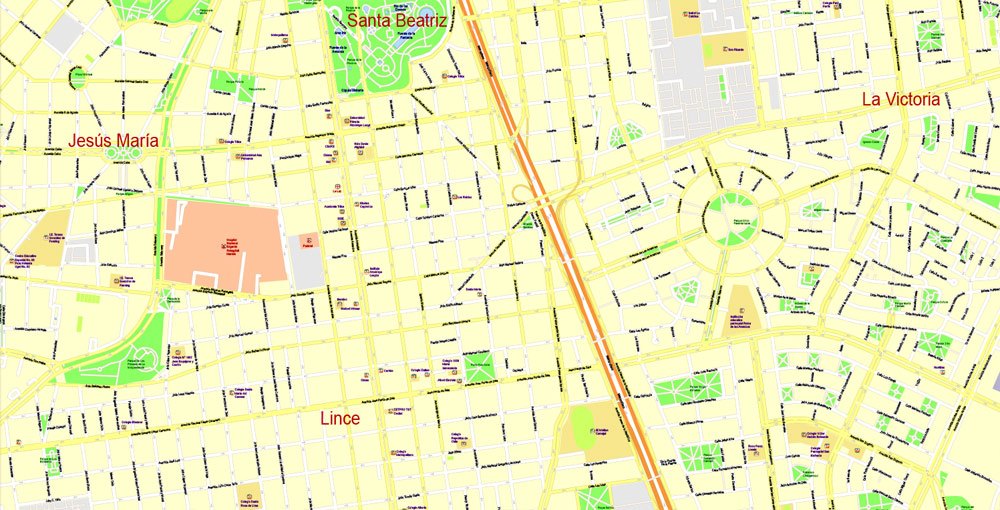
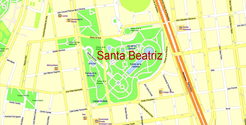
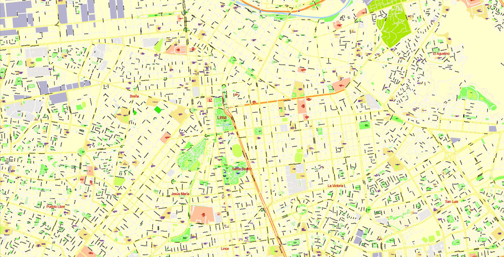
Urban plan Lima Peru Fully Editable Vector
Video: Simple Vector Maps Work Manual:
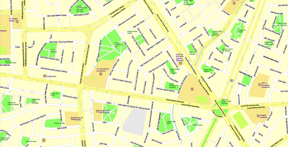
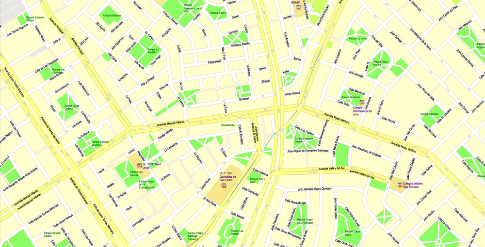
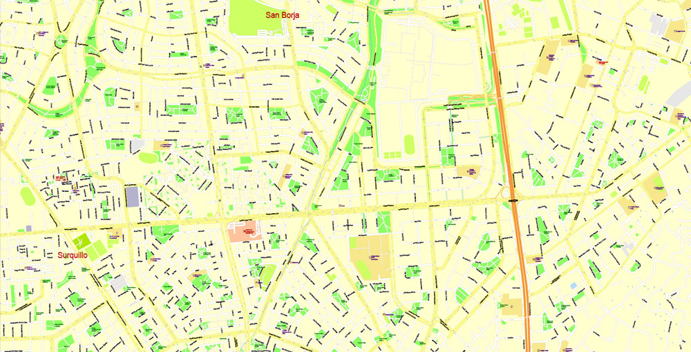
Urban plan Lima Peru Version 2: Fully Editable Vector
The capital of the state of Peru - a country of sunny beaches and ancient Indian relics - is Lima. This multimillion city is located at the foot of the Andes, 12 km from the Pacific coast. Like most megacities, Lima is a city of contrasts. The luxury and splendor of the villas of the rich, located on the coast, are adjacent to the squalor and poverty of the shacks of the central districts. Nevertheless, thousands and tens of thousands of tourists who annually flood its streets, visit its museums and attractions want to plunge into the atmosphere of this city. They are not deterred by either the unfavorable climate or the high crime rate, because Lima gives its guests a unique opportunity to get to know the most interesting history of Peru, visit historical monuments of the period of the conquistadors, and the development of South America. In addition to spiritual enrichment, the capital of the country also offers a wide range of entertainment from beach holidays during the day to various entertainment events in the evening and at night.
Ciudad de Los Reyes, or the "City of Kings", is how its founder, the Spanish conquistador Francisco Pissaro, dreamed of naming his city when he planned his project in 1535. However, this name somehow did not catch on with the locals, who nicknamed the new settlement Rimak in honor of the river on which it was located. Subsequently, this name was distorted and gradually transformed into the modern "Lima". Initially, the founders of the city were attracted by a bay convenient for ships, as well as fertile lands, but they were able to "evaluate" all the disadvantages of the local climate a little later. Nevertheless, the city began to develop actively in such unfavorable conditions.
When Peru was granted the status of the viceroyalty of Spain in 1543, Lima became its capital and literally blossomed before our eyes. In the shortest possible time, the territory of the city was built up with palaces and mansions of the viceroy and the nobility, Catholic churches, fountains, and arches. Many of these buildings have survived to this day, being an ornament of the old part of the city. For three centuries, Lima has been the most developed city in South America.
However, in 1810, with the outbreak of the War of Independence, her situation deteriorated sharply. In September 1820, Lima was captured by General Jose de San Martin, who led the rebel army, and the following year the city became the capital of newly independent Peru. Almost the entire XIX - early XX centuries, wars were waged on the territory of the state, which led Lima to the deepest economic crisis.
She began to leave it only by the 30s of the last century. However, the unstable political situation, the constant change of military governments, which lasted until the 90s, did not allow Lima to fully recover. In 1994, the capital finally stopped being shaken by constant cataclysms, and it began to develop actively.
Currently, Lima, as befits the main city of the state, is its cultural and political center. In addition, it plays a crucial role in the development of the country's economy and industry. The offices of the largest foreign and domestic companies and banks are located in the business districts. About 80% of manufacturing enterprises are located in Lima and its suburbs. There are factories of metallurgical, chemical, automotive, shoe, textile, and other industries. The city is also the largest transport hub, through which the most important railway routes and highways pass. There is also an airport near Lima.
The population of the capital of Peru is about 7.8 million inhabitants, that is, about a third of the total population of the state lives here. Lima is quite multinational. Along with the indigenous Aymara and Quechua Indians, there are many Europeans, Peruvians, as well as representatives of Asian nationalities, mainly Japanese and Chinese.
In order for a vacation in Lima to be as pleasant as possible, it is necessary to choose the right time of year for a trip, since the local climate is very changeable and fastidious. The best time to visit the resort is in March, April, and December when the sun is shining and the temperature is not too high. At this time, it ranges from +21 to +28 C. From May to November, sunny days in Lima are rare, as the sky is constantly covered with low yellowish clouds. In addition, this period is accompanied by garua - a thick fog hanging very low above the ground. In general, the humidity in the city is constantly very high, while there is practically no rain.
But despite the disadvantages of the climate, Lima does not lack tourists who come to the city in order to get acquainted with its many attractions. The architecture of the city is an unusual mixture of Spanish colonial and Native American traditional styles, from the symbiosis of which a separate Creole trend in architecture has emerged. At the same time, there are also many modern buildings built at the end of the twentieth century.
The main cluster of historical architectural monuments is located in the Old City, built in the era of the development of South America. In 1991, it was classified as a World Cultural Heritage Site protected by UNESCO. The central place in this area of the city is occupied by Armas Square, from which the foundation of Lima began. In its center, on the spot where the medieval bonfires of the Inquisition once burned, there is now a stone fountain. The square is surrounded by many other attractions.
In its northern part, the Presidential Palace has been erected, the foundation of which was laid during the lifetime of the founder of Lima. Opposite it is the Cathedral of Santo Domingo - the oldest and most beautiful building in the city with carved wooden balconies. In his chapel is the burial of Francisco Pissaro. One side of the coffin with his body is glass, so visitors can see the mummy of the great conquistador.
Also not far from the square is the monastery of St. Francis, founded by Franciscan monks in the XVII century. He managed to survive several earthquakes that destroyed many ancient buildings in Lima. The main value of this temple is the collection of paintings "Apostles", made by Spanish artists. There are extensive catacombs under the monastery, which served as a local cemetery during the time of the conquistadors.
There are a number of old Catholic churches in the Old Town, such as the churches of St. Augustine, St. Peter, St. Marcelo. Many mansions and palaces of the nobility, made in the Baroque style, have been preserved here. Many of them are decorated with columns and balconies, carvings, and stucco. You can learn more about the history of Lima and the whole of Peru from the moment the first person appeared on this territory to the present day by visiting the numerous museums of the capital. The most famous among them are the National Museum of History, the Museum of the Republic, the Museum of Peruvian Culture, the National Museum of Anthropology and Archaeology, the Museum of the Viceroyalty.
The Miraflores area of Lima also deserves a visit, where the bulk of theaters and restaurants are located. The first theatrical performance in the city was given back in 1548, it took place in the open air on San Pedro Square. Since then, interest in this kind of art has not faded, and now about 10 theaters have been opened in Lima, the largest of which is the Municipal Theater. Lima's bohemian Barranco district is the center of its nightlife. It is here that you can walk along the street of Lovers leading to the observation deck on the Pacific Ocean, go to the Bridge of Sighs, in general, plunge into the romantic atmosphere.
The rich outskirts of the city facing the coast are also picturesque. This part of the city is strikingly different from the poor and criminal quarters of its central part. The main mass of hotels, supermarkets, and boutiques, as well as various entertainments, are located here. Those tourists who want to bring home memories of Lima can be advised to visit one of the "Indian markets", which are a real treasure trove of the most diverse and original souvenirs.
It is not recommended to visit the beaches located on the territory of Lima because of their neglect and overcrowding by local residents. But south of the capital, there are quite decent places for swimming, the most popular among foreign tourists are the beaches of Caballeros, Signoritas, Punto Hermosa, San Bartolo, and Napo.
Lima has a little time left before its five-hundredth anniversary. Once this city was the capital of the whole New World. At the time of its foundation, in the XVI century, Lima was called the City of Kings and was indeed a majestic outpost: the stunning Viceroy's palace, grandiose cathedrals, and luxurious villas gave the city charm for centuries. In 1991, Lima has declared the cultural heritage of humanity by UNESCO for the fact that the architecture of the colonial period is still preserved here.
Lima is ideal for starting a trip to Peru. Everyone is happy in this city: young people and lovers of outdoor activities, couples with children, romantics, and connoisseurs of archaeological finds.
Peru is a country located in the western part of South America. The official name is the Republic of Peru. It borders Ecuador and Colombia in the north, Brazil, and Bolivia in the east and Chile in the south.
The total area of the country is 1.28 million square kilometers. Peru is one of the largest countries in Latin America.
The state is divided into three regions: the Coast (Costa) on the eastern coast of the Pacific Ocean, the Mountains (Sierra) - in the middle of the Andes and Selva (Selva) - in the western part of the Amazon.
In the west, the territory of the country is washed by the waters of the ocean.
The largest river in the country is the Amazon, the largest lakes are Titicaca and Junin. Lake Titicaca is the largest high-altitude navigable body of water on the planet. Its area is 8287 sq. km.
The westernmost point of the country is Cape Parinhas.
A complex mountain system stretches across the entire territory of the countries from north to south, which consists of a chain of ridges of the Peruvian Andes and Cordillera.
The highest point of the country is the dormant volcano Huascaran, whose height is 6768 meters.
Related Images "Urban plan Lima Peru 2 parts":
Lima Peru Digital Maps for Business, Logistics, Education

Peru - Lima Touristic Maps in AutoCAD DWG DXF, Adobe Illustrator, PDF

Lima Peru - Travel Maps and Wall Art Printing: City Street Maps Peru

- Urban plan Aston Birmingham
- Urban plan Haifa Israel pdf
- Urban plan Medellin Colombia
- Urban plan Rouen Metro France PDF
- Urban plan Syktyvkar
- Urban plan Macau China 125 PDF
- Urban plan Ivanovo PDF Russia
- Urban plan Ireland Admin
- Urban plan Darwin Australia
- Urban plan Toronto Billy Bishop
- Urban plan Dallas
- Urban plan Toulon France
- Urban plan Luxembourg City PDF
- Urban plan Romania Topo Road
- Urban plan Long Beach California PDF
- Urban plan Bend Oregon PDF
- Urban plan New York City Metro
- Urban plan Hampton Roads Virginia
- Urban plan Perm pdf
- Urban plan Beijing
- Urban plan Kyoto Japan 16 ai
- Urban plan Bruxelles Brussels Belgium
- Urban plan Aarhus Denmark pdf
- Urban plan Harlingen Texas 3 10 PDF
- Urban plan Santa Clara California
- Urban plan Southampton UK
- Urban plan Kaliningrad PDF Russia
- Urban plan Rome Italy
- Urban plan Bruxelles Brussels Belgium CDR
- Urban plan Sarajevo Bosnia Herzegovina ai
- Urban plan Munchen Germany
- Urban plan Prague Praha metro Czech Republic PDF
- Urban plan Yuma Arizona PDF
- Urban plan New Orleans
- Urban plan Baltimore Counties
- Urban plan Helsinki Finland
- Urban plan Copenhagen Kobenhavn Denmark PDF low
- Urban plan Portsmouth UK ai
- Urban plan Asuncion Paraguay
- Urban plan Pskov Russia PDF
- Urban plan Vienna
- Urban plan Cape Canaveral Florida
- Urban plan Charlotte North Carolina PDF
- Urban plan Ottawa
- Urban plan Portland Maine
- Urban plan Austria Vector Roads CDR
- Urban plan Reading Pennsylvania
- Urban plan Sacramento California
- Urban plan Cambridge UK PDF
- Urban plan Cleveland Ohio
- Urban plan Napier Hastings New Zealand PDF
- Urban plan Murmansk PDF Russia
- Urban plan Santo Domingo Dominicana