Urban plan Yaroslavl Vector Map Printable Editable
Gallery of Images "Urban plan Yaroslavl" (625 pics):
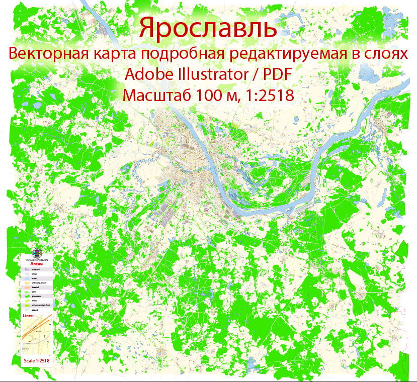
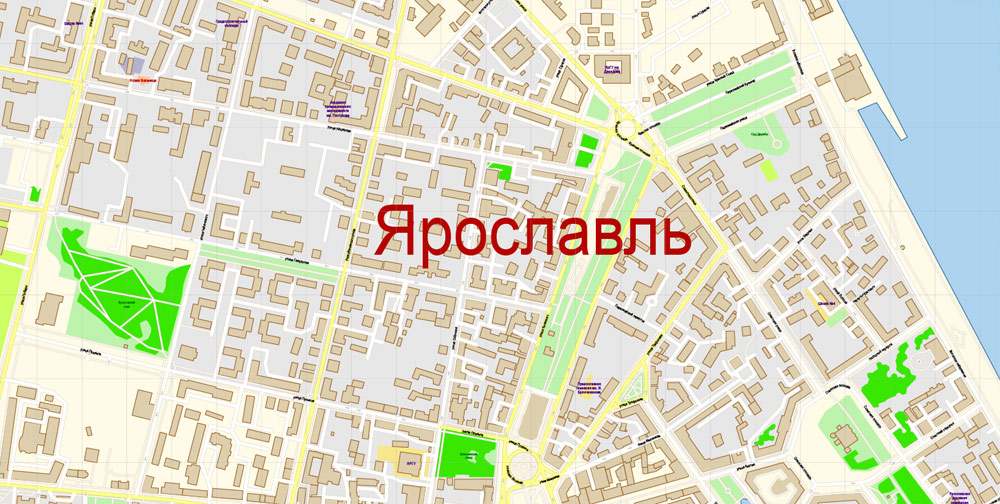
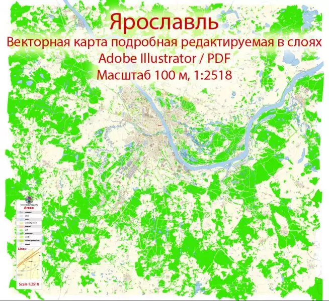
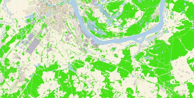
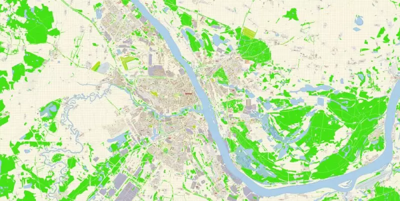
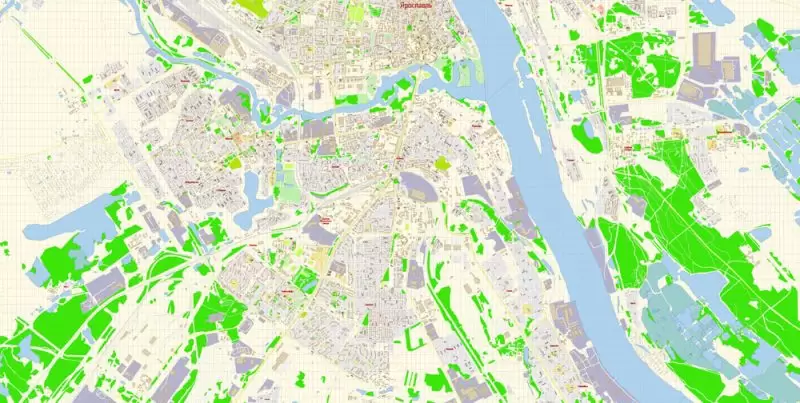
Yaroslavl - Editable Map


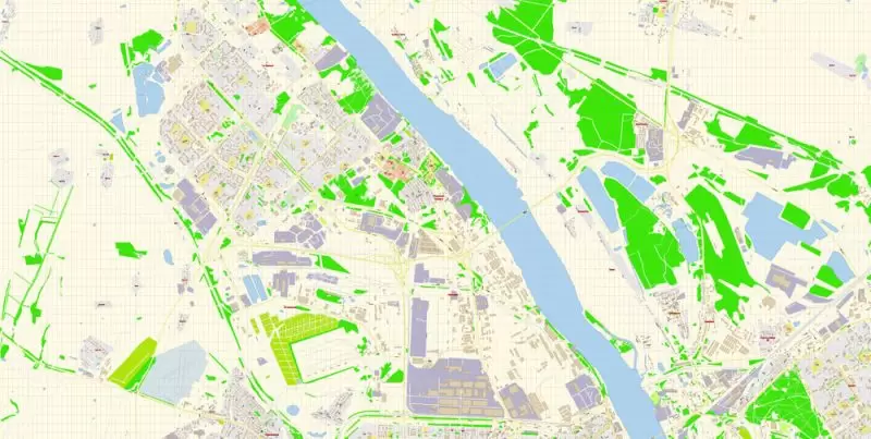
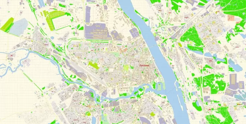
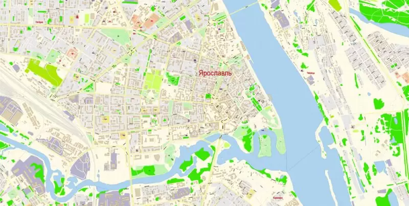
Urban plan Yaroslavl: Editable Vector Map
Yaroslavl is a city in Russia, the administrative center of the Yaroslavl region. Population — 601,403 people . Yaroslavl is the third most populous city in the Central Federal District of the Russian Federation. The city is a transport hub from which railway lines and highways diverge in the direction of Moscow, Vologda, Rybinsk, Kostroma, Ivanov and Kirov. There is also a river port and an airport in Yaroslavl. The area of the city is 205.8 km2.
Yaroslavl is one of the oldest Russian cities, founded in the XI century and reached its heyday in the XVII century; in 2010 the city celebrated its millennium. City Day in Yaroslavl is usually celebrated on the last Saturday of May (in 2010, in connection with the millennium of the city, the celebration was held from September 10 to 12). The historical center of the city, located at the confluence of the Volga and Kotorosli rivers, is a UNESCO World Heritage Site.
Administratively, Yaroslavl is the center not only of the region, but also of the Yaroslavl district, which it is not part of. It has the status of a city of regional significance and forms the city district of Yaroslavl with the only settlement in its composition.
Geographical location
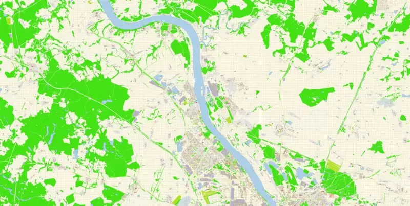
Yaroslavl is located in the central part of the East European Plain (more precisely, on the Yaroslavl-Kostroma lowland) on both banks of the Volga at the confluence of the Kotorosli River; 282 kilometers northeast of Moscow. The city covers an area of 205.37 km2. The average height of the city center is 100 m above sea level.
Time zone
Yaroslavl is located in the Moscow Time zone (Moscow time). The offset of the applied time relative to UTC is +3:00. In accordance with the applicable time and geographical longitude, the average sunny noon in Yaroslavl comes at 12:21.
Hydrology
The main rivers of Yaroslavl are the Volga (Gorky reservoir) and its right tributary Kotorosl, the level of which is raised by the support of the Nizhny Novgorod hydroelectric power station. Several rivers and streams flow into them, the most significant of them is the Nora River. In the Kotorosli riverbed, closer to the mouth, there are several islands; on one of them, Damansky, there is a park of culture and recreation. The right bank of the Volga is high, steep, the left is low-lying. The average annual water consumption of the Volga near Yaroslavl is 1110 m3/s, the average long-term value of the level of the Gorky reservoir near Yaroslavl is 84.28 m.
Climate
The city is located in a temperate continental climate zone, with a great softening influence of the Atlantic. The sum of the temperatures of the growing season (above +10 °C) is 1892 °C. The number of days with a temperature below zero is 150 days. The annual precipitation is 544 mm . The amount of precipitation of the cold period is 146 mm . The amount of precipitation during the warm period is 398 mm .
In the old days, the Kotorosl River was famous for its annual floods
Winter in Yaroslavl is moderately cold, moderately snowy, lasts for more than five months. The average temperature in January is -10...-11 °C, in some winters frosts can reach -40 ...-46 °C; but thaws also occur, for example, in 1932 in January the longest thaw was observed for the entire observation period (17 days). The height of the snow cover is 35-50 cm, in some winters it reaches 70 cm, but sometimes it barely exceeds 20 cm. Snow cover is established in the second half of November and persists for 140 days. Winds from southern and western directions prevail. The average wind speed is 4.2 m/s, strong winds, more than 8 m/s, and blizzards are observed mainly in December - January, up to 8-10 days.
Spring is characterized by low precipitation. The average April temperature in Yaroslavl is about +4 °C. The snowfall occurs in the first half of April. Precipitation in April is low - 30-40 mm, their increase begins in May, when more than 50 mm of precipitation falls. In May, the lowest relative humidity of the year is observed - about 70%.
Summers are moderately warm, humid, with the highest rainfall of the year — up to 70-80 mm per month. The average monthly temperature in July is +18 °C, on some hot days the temperature exceeds +30 °C; the absolute maximum reaches +37.5 °C. In July, the highest amount of precipitation falls in a year — more than 70 mm per month. The rains are mostly torrential, often with thunderstorms (in June — July up to 6-8 days with a thunderstorm). Winds from the western and northern directions prevail. The average speed is 2.5-3.5 m/s.
Autumn is characterized by a sharp increase in cloudy skies - up to 18 days a month and an increase in relative humidity up to 85%. The average October temperature in Yaroslavl is about +4 °C. The amount of precipitation decreases, but their nature changes — there are heavy rains and fogs arise.
Gallery of Images "Urban plan Yaroslavl":
Vector Map of the Yaroslavl, Russia


Yaroslavl city, Russia Cartography and Map


Yaroslavl - World Heritage Site - Maps for Printing


Russia - Historical Centre of the City of Yaroslavl Printable Map
Векторная PDF карта Ярославль, подробная редактируемая, в слоях, для дизайна и полиграфии в формате Adobe PDF, масштаб 100 метров 1:2518 объем 25 мегабайт.
Все улицы с наименованиями, основные объекты, здания.
Карта предназначена для редактирования и печати в любом формате, полностью масштабируемая без потерь качества.
Для полиграфической рекламы, дизайна, туристических компаний, логистического бизнеса, архитектуры, строительства, проектирования.
Слои: color_fills, streets_roads, labels_roads, names_objects, names_streets, names_places, water, buildings, grids, legend, etc.
Самая точная и подробная карта города.
DWG, DXF и другие форматы – по запросу, пожалуйста, свяжитесь с нами.

- Urban plan North East Tasmania CDR
- Urban plan Eugene Oregon 3 10
- Urban plan Golden Gate Park San Francisco
- Urban plan New Haven Connecticut PDF
- Urban plan Washington DC
- Urban plan Copenhagen Kobenhavn Denmark pdf
- Urban plan Turin Torino Italy
- Urban plan Yokohama Japan 13 pdf
- Urban plan Boston Massachusetts
- Urban plan Eugene Springfield Oregon PDF
- Urban plan Hungary Relief Road
- Urban plan Inari Ivalo Saariselka PDF
- Urban plan Brisbane Australia PDF
- Urban plan Madrid Spain PDF
- Urban plan Madrid Spain AI
- Urban plan Eugene Oregon
- Urban plan Jerusalem Israel 17 english AI
- Urban plan Albany NY
- Urban plan Albury Wodonga Australia PDF 17
- Urban plan Saint Louis Missouri 4 10 PDF
- Urban plan Voronezh
- Urban plan Adelaide Australia 3 11
- Urban plan Basel Switzerland CDR
- Urban plan Ivanovo PDF Russia
- Urban plan Spokane Washington AI
- Urban plan Albany New York PDF
- Urban plan Laval Quebec PDF
- Urban plan Roads Dominicana
- Urban plan Bruxelles Brussels Belgium
- Urban plan Kansas City Lawrence Topeka
- Urban plan Des Moines Jowa 3 10
- Urban plan Wind Point Wisconsin AI
- Urban plan Fortaleza Brazil PDF
- Urban plan Santo Domingo Republica Dominicana PDF
- Urban plan Florence Firenze Italy PDF
- Urban plan Genova Genoa Italy
- Urban plan Dominican Republic Detailed a3 PDF
- Urban plan Belgium Administrative PDF
- Urban plan Antwerpen Belgium
- Urban plan Cleveland Ohio PDF
- Urban plan Seattle Washington
- Urban plan Kemi Tornio Finland
- Urban plan Lyon France